
Unmanned measuring systems
The usage of unmanned measurement systems significantly increased the efficiency and safety of our measurements. The field work time is reduced to a necessary minimum, thanks to that customers can get the finished products even the next day.
The UAV systems market is growing and improving every year. Thanks to the constant technological progress unmanned systems can achieve similar accuracy as professional surveying equipment. High-quality digital camera allows to reproduce even the smallest details, and by using our professional surveying equipment we can transform the final product to any global or local coordinate system.
Unmanned measurement systems can deliver a wide variety of high quality products
Such diversity allows us to work with companies from different industries:
Construction industry
Companies related to the constructions of large linear objects like roads and railways or other large-scale construction works. The documentation created by a UAV system is beeing use at every stage of the project from the design stage to a final as-built survey.
Energy industry
Condition of power lines elements deteriorate over time. With UAV we can provide a complete information about the current state of technical infrastructure especially where the traditional inspection methods would be impossible or uneconomic.
Preservation of historic monuments
Taking photographs of inaccessible parts of a building with a UAV significantly reduces costs and increases the safety of our work. With the captured images we can generate a dense point cloud or a precise three-dimensional model of the object.
Environmental protection
Orthophotos or point clouds gather by the UAV system can be used for monitoring of natural environment degradation occured over time. This is a perfect way to document the destruction caused by natural disasters or by human activity.
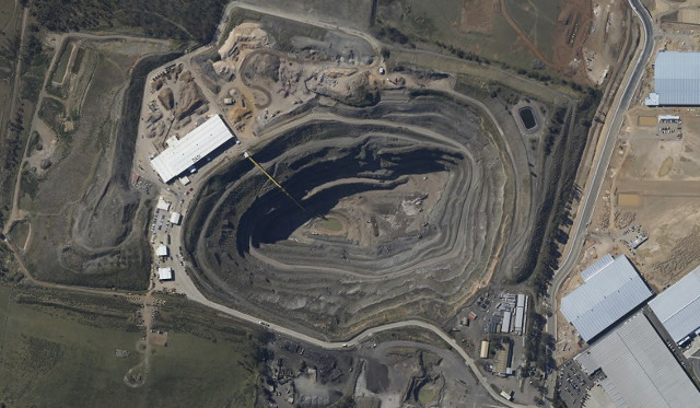
Opencast mining and waste storage
The use of unmanned system contributes to increasing security and significantly speeds up field work. This the best way to accurately measure the volume of a complex land shape.
Advertising and commercials,
High-quality photos or videos from flight perspective are often used to create advertising materials like building or terrain visualizations.
Orthophotos
Orthophotomaps are created by merging a set of overlapping high-quality digital photos and transforming them to a known coordinate system. The final orthophoto has all the features of a traditional geodetic maps and it is maintaining the scale throughout the entire range. The orthophoto can also serve as a underlay for a traditional map, complementing it and allowing for eventual information updates.
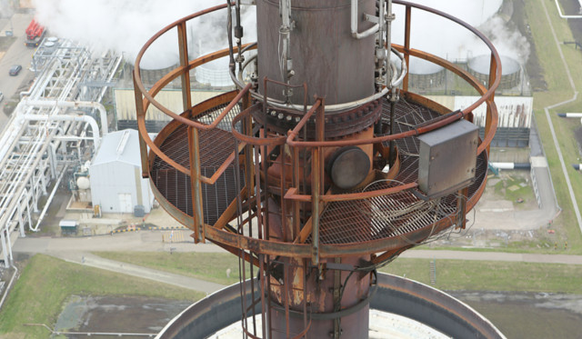
Inspection of inaccessible places
The best way to inspect hard to reach places is to use flying unmanned systems equipped with a high-quality digital camera. This allows for a direct access to the parts of the object that are in the area of our interest. This is the fastest and most secure way to create a complete digital documentation of building or industry instalations.
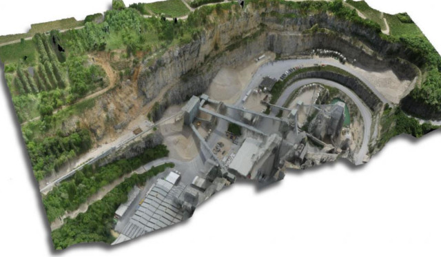
Volume calculations and digital terrain models
The aerial photos are used to create very accurate digital terrain models which are used to calculate the overall volume of the stored material. In addition, by performing measurements of the landfill in precise time intervals, we are able to determine all changes in the amount of the material. Highly accurate digital terrain models created from the UAV photos are a faithfull representation of the current shape of the terrain, this allows to plan transport routes for vehicles or plan future extraction.
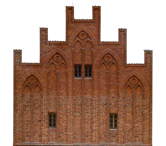
High resolution elevation orthophoto
With the combination of a high resolution digital camera, UAV and a specialized software we can create very detailed pictures of the facade in the orthogonal projection. Orthophoto mainain the resolution and dimensional accuracy throughout every part of the picture. It is an ideal tool for archiving facades of tall buildings.