Portfolio
Below are some of our recent projects
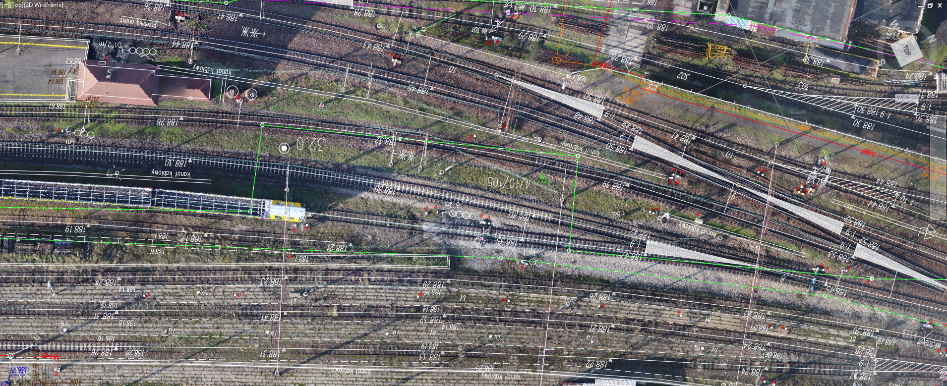
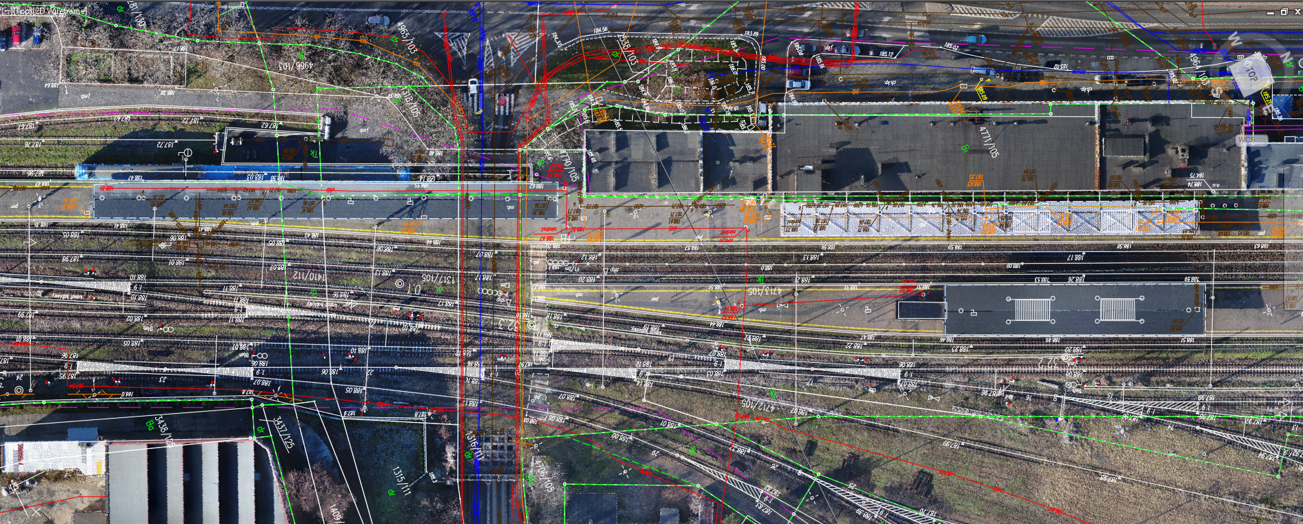
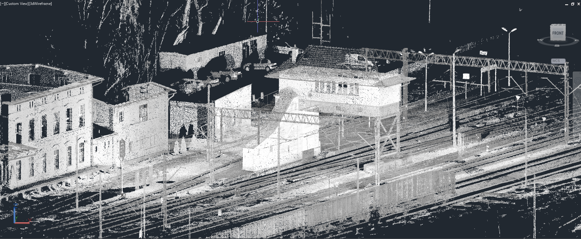
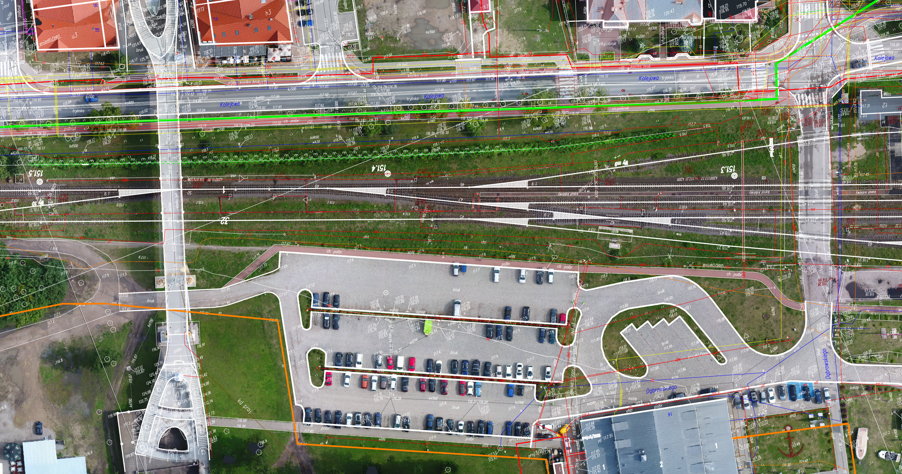
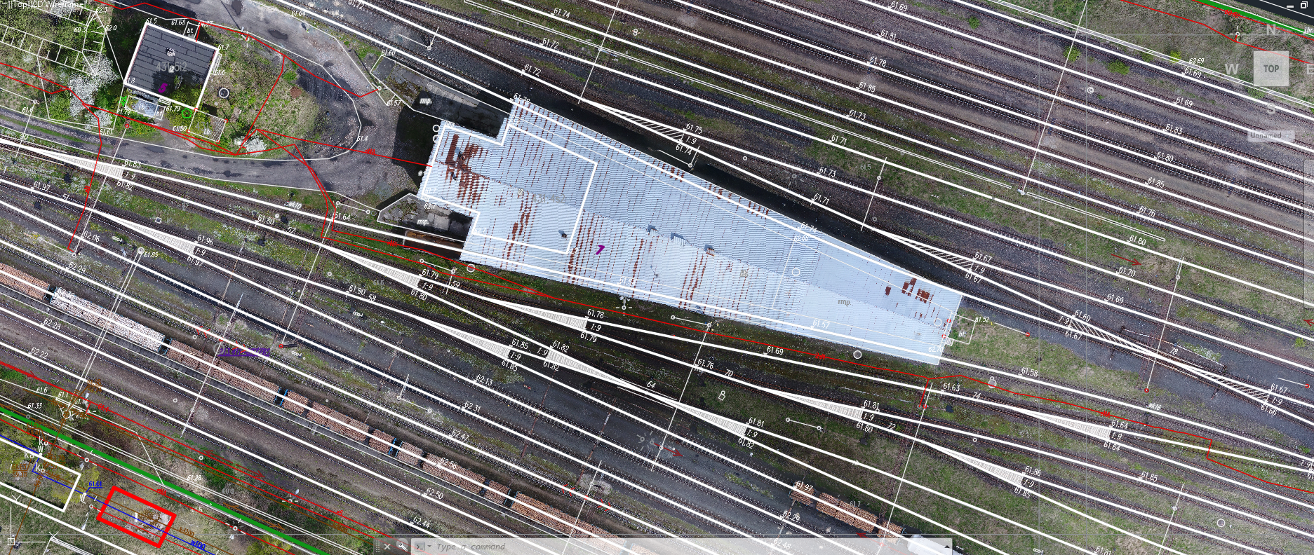
Map for design purposes for Racibórz station.
The scope of work in addition to the 60 hectares of the map for design purposes included an orthophotomap, 3D scanning and modeling of engineering objects.
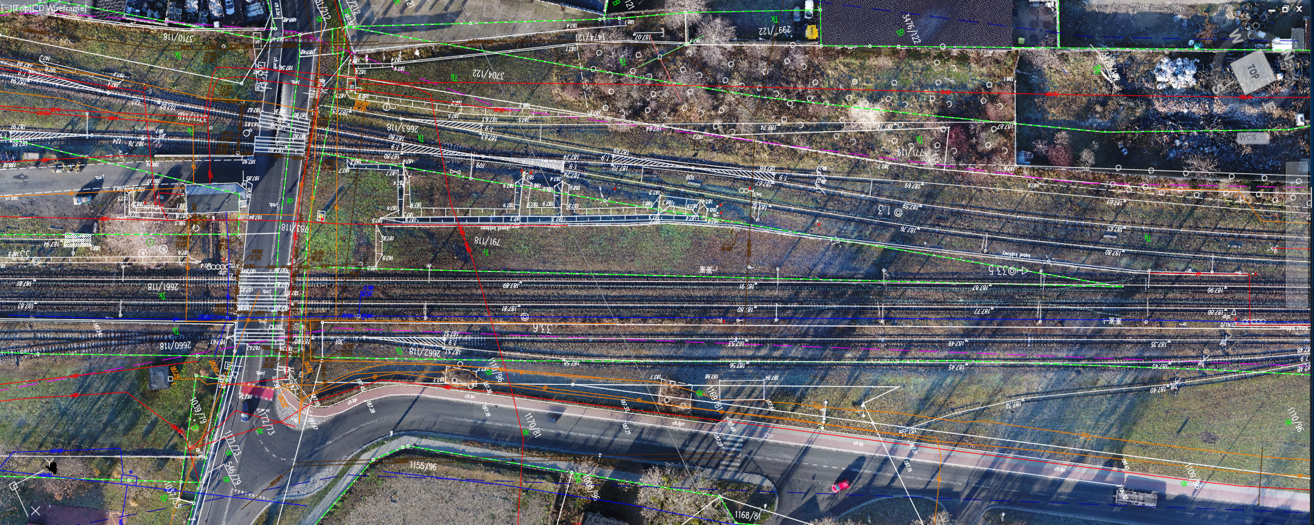
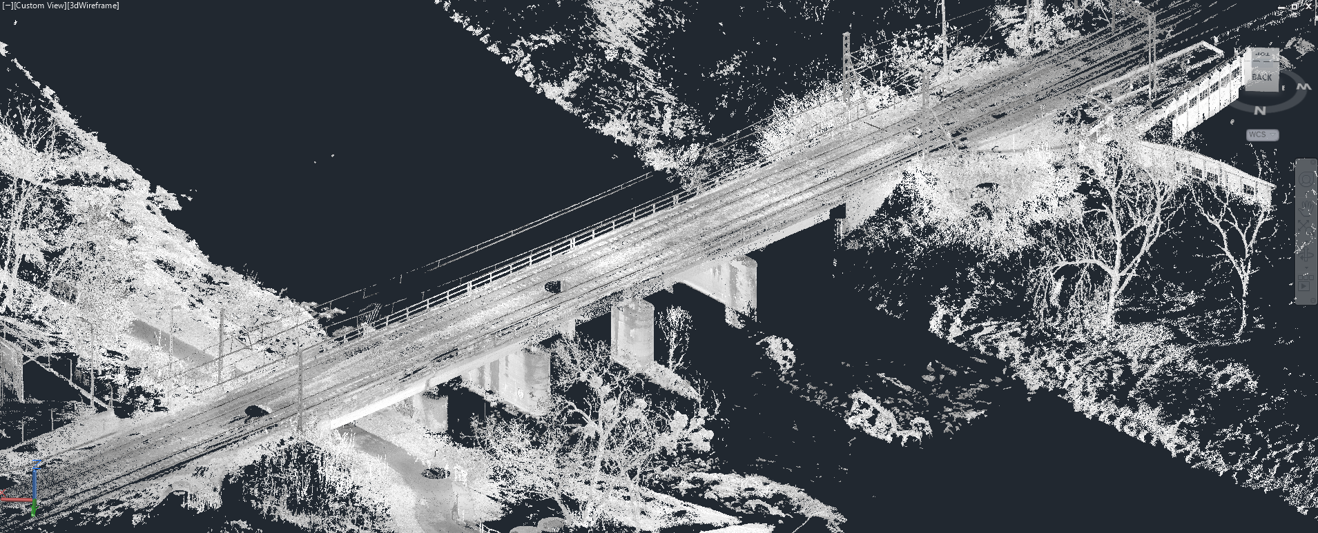
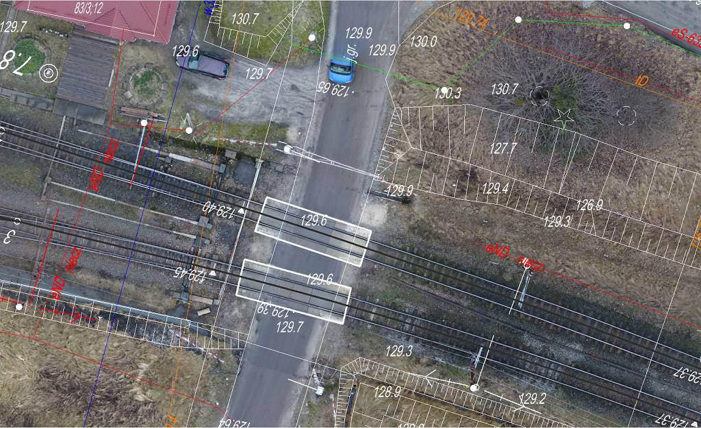
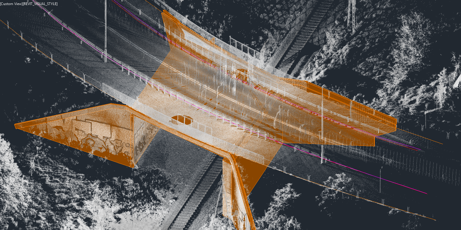
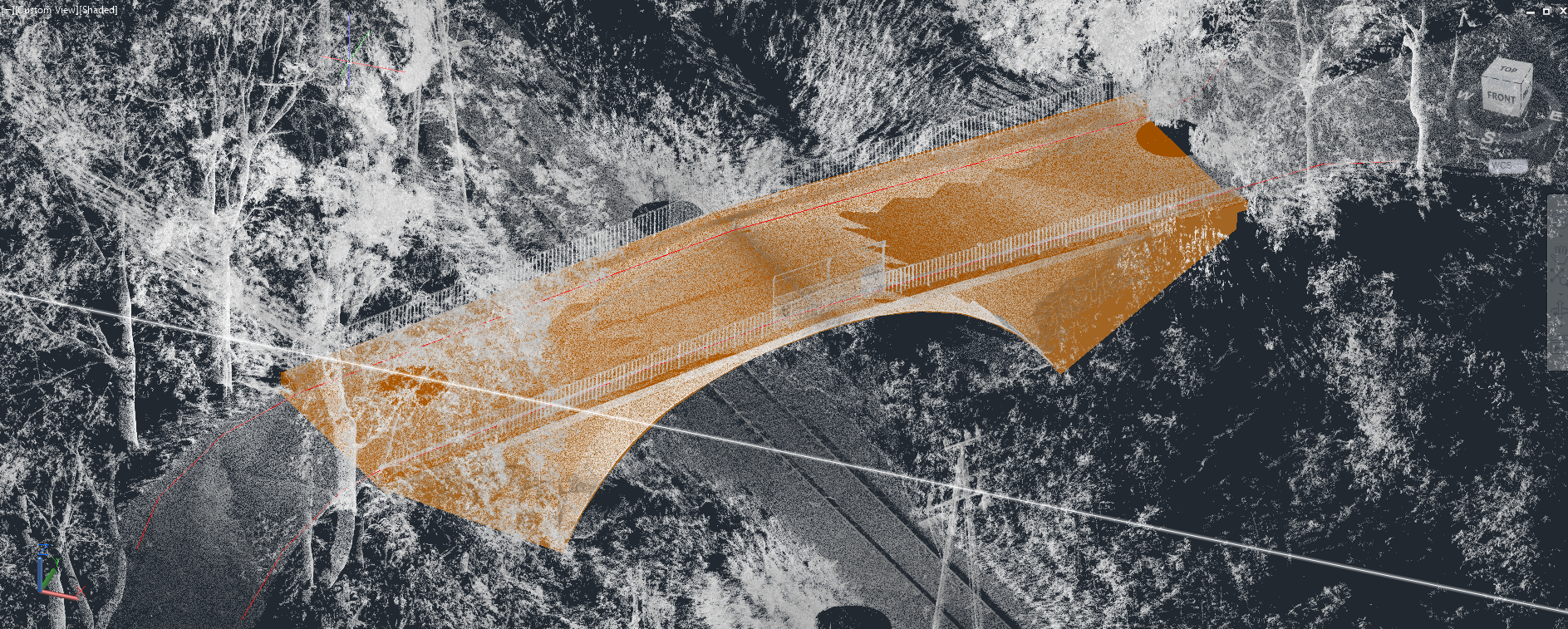
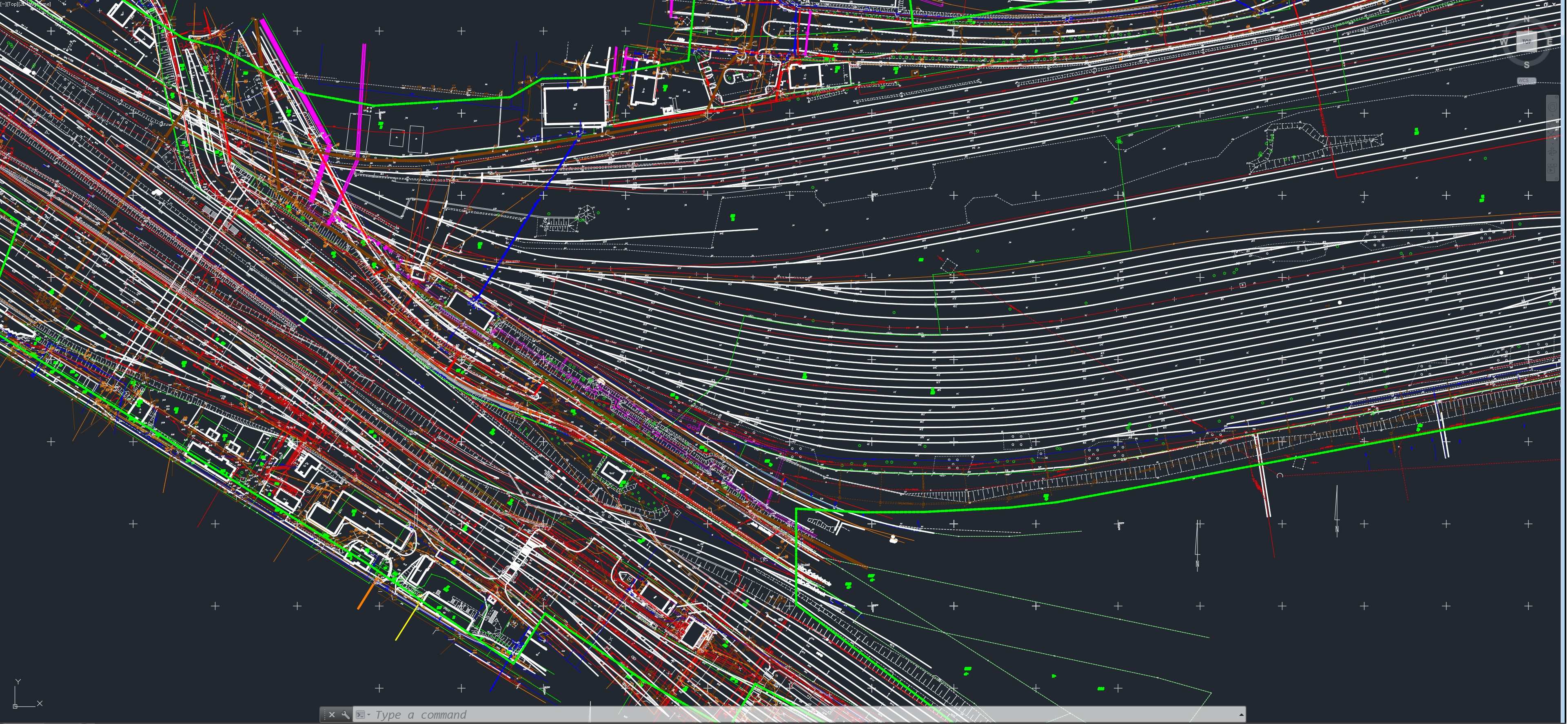
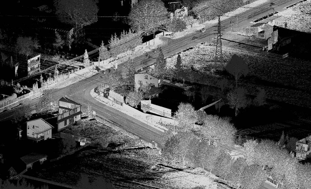
Railway line 221
We created a map for design purpose for railway line 221 Olsztyn-Gutkowo-Braniewo, with high resolution orthophotomap as raster background also we modeled viaducts and filmed a drone flight video over railway tracks
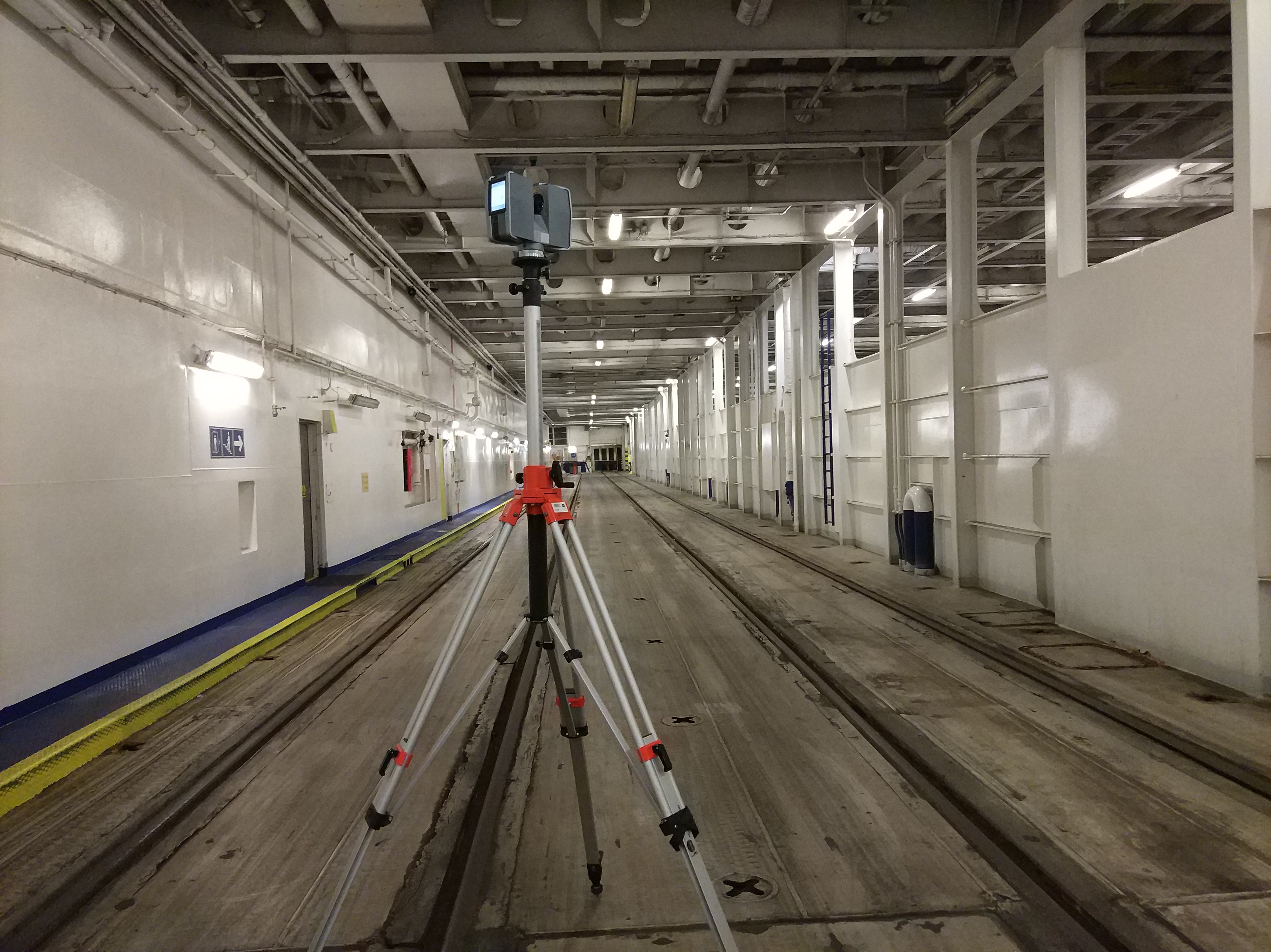
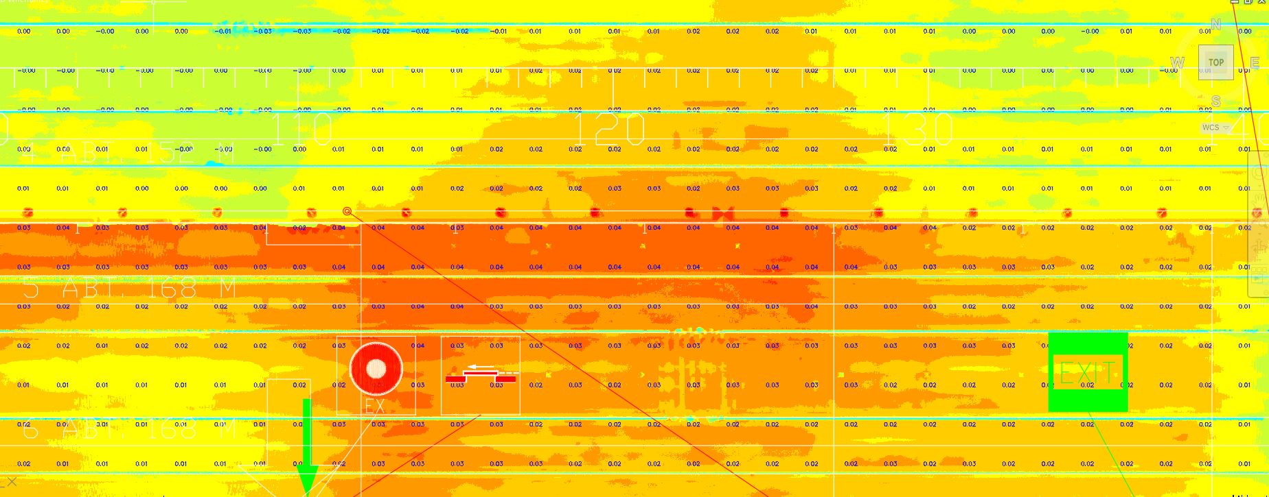
Determination of ship deck deformation and control of track geometry on board.
The transport ferry was built in 2008, after years of operation it requires a comprehensive reconstruction. Part of the work is the repair of the deck for freight wagons. We created a map of deformation of the deck surface and controled the geometry of railway tracks on the deck . The collected data will be used to plan the course of repair work


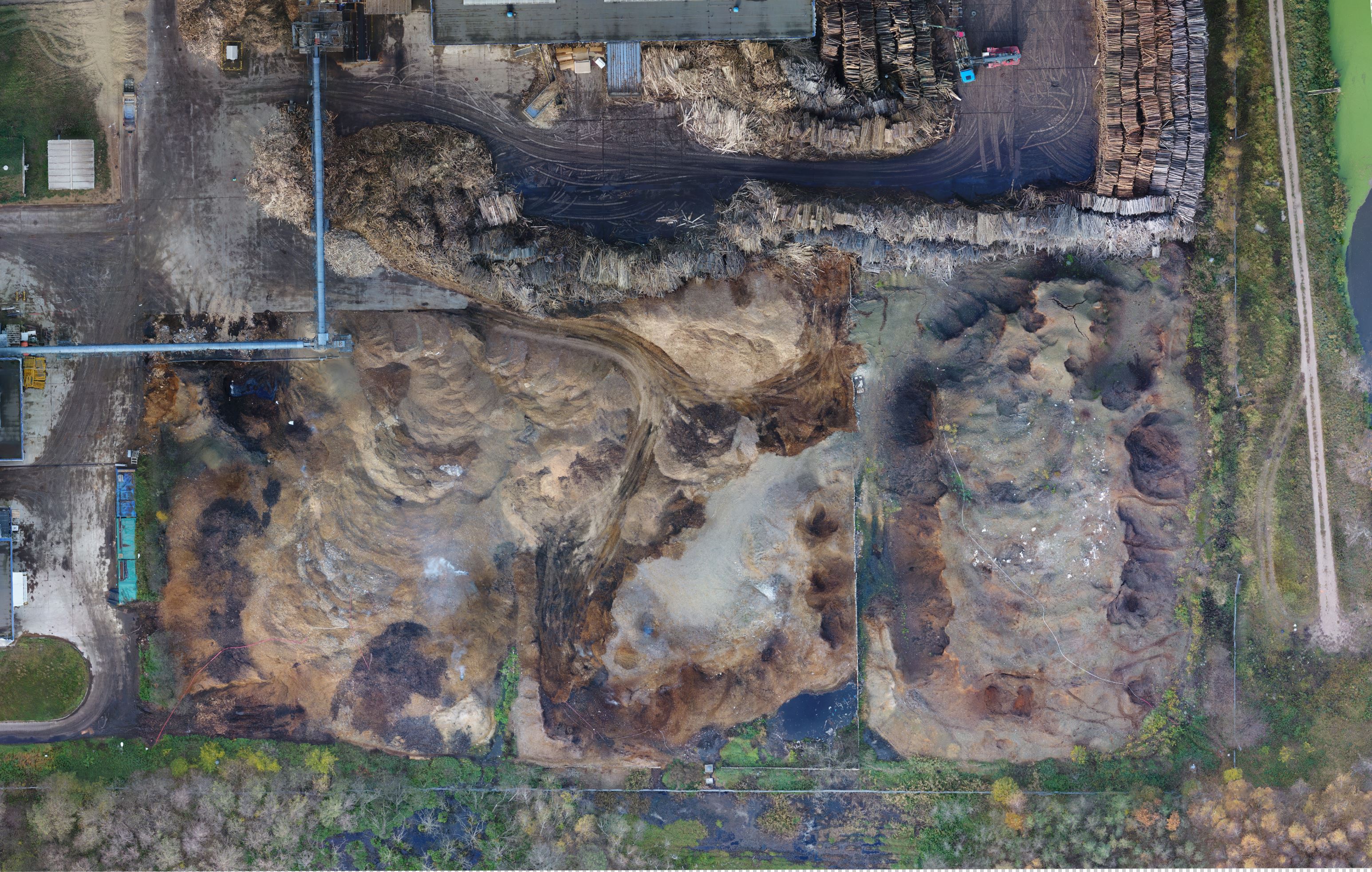
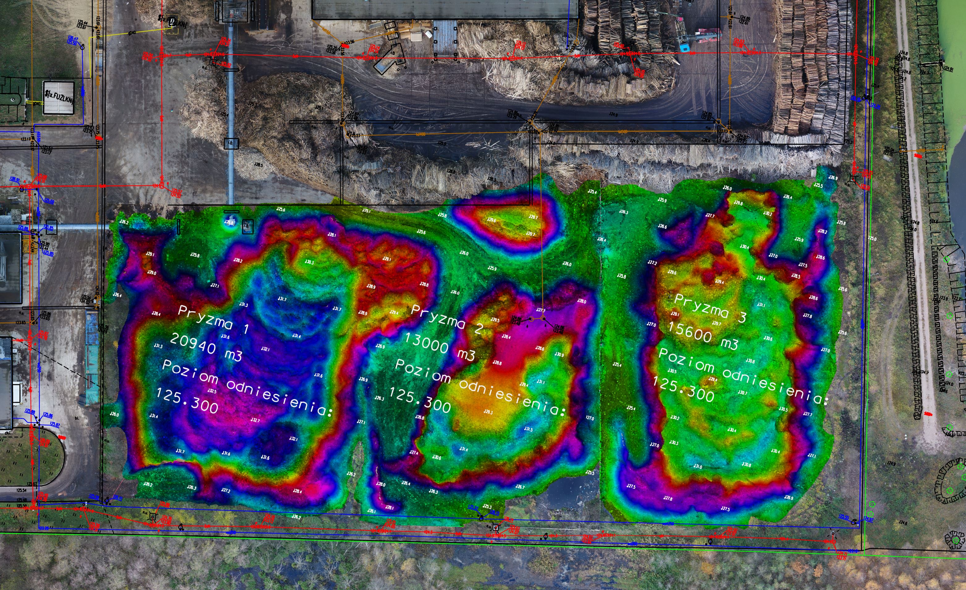
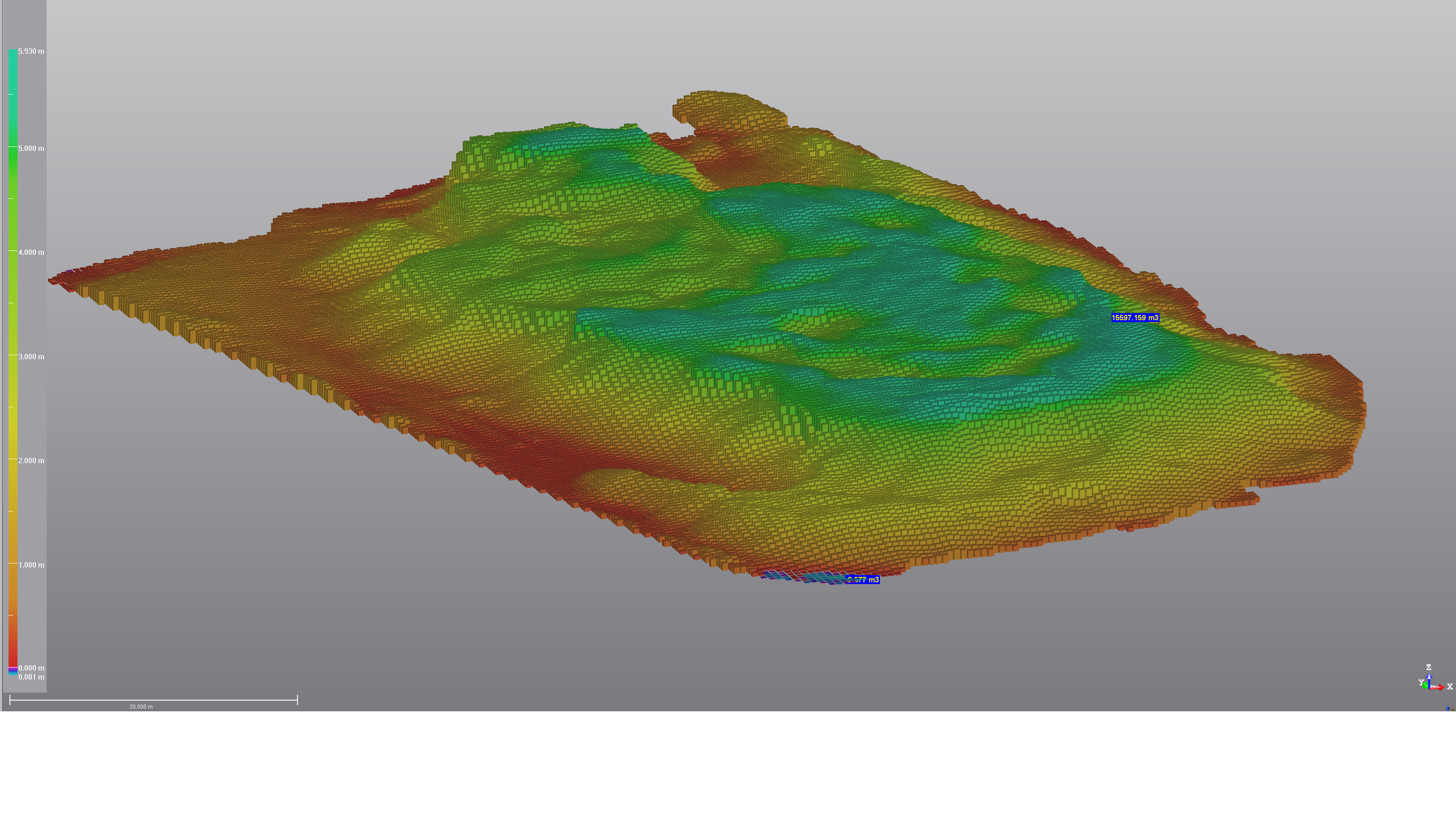
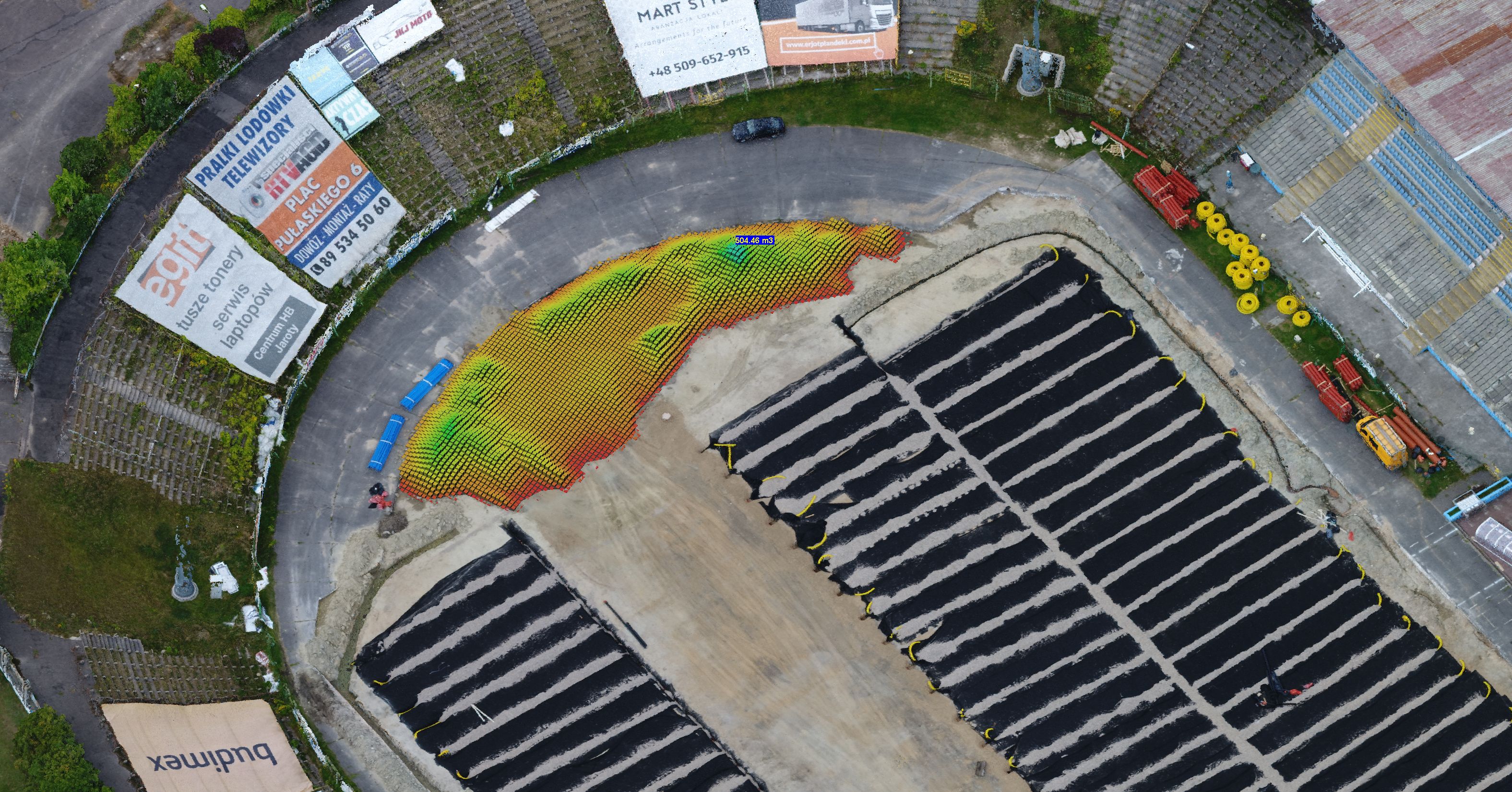
Periodic measurements of biomass volume.
In order to check the resources and control the average biomass consumption, we perform periodic volume measurements of three neighboring piles.
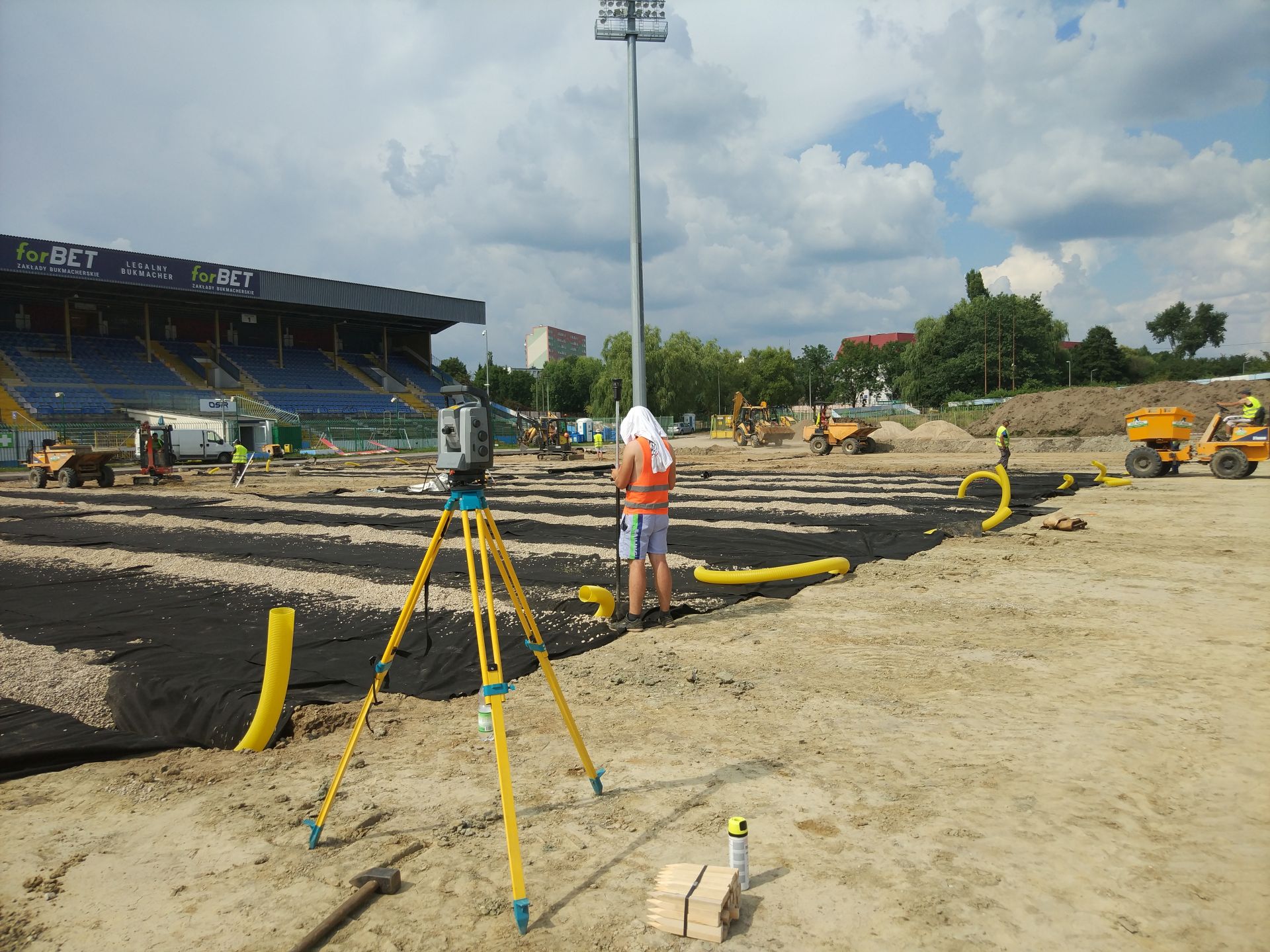
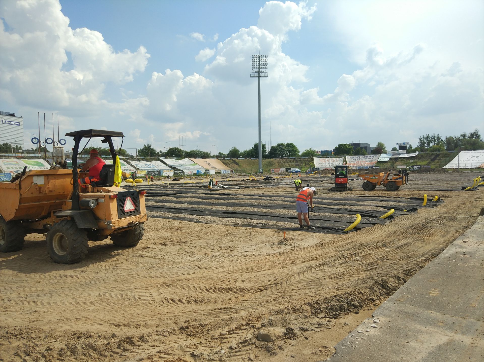
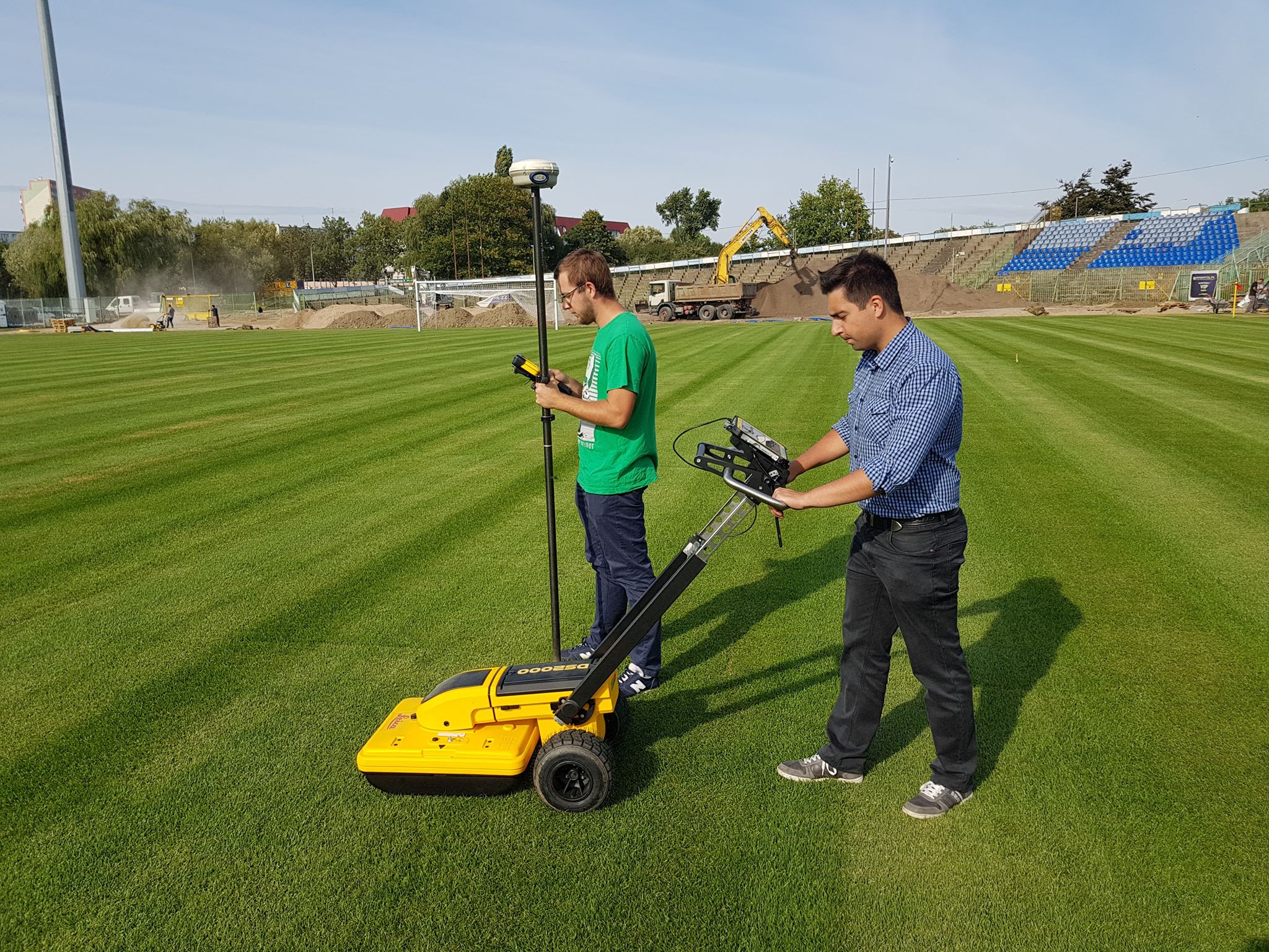
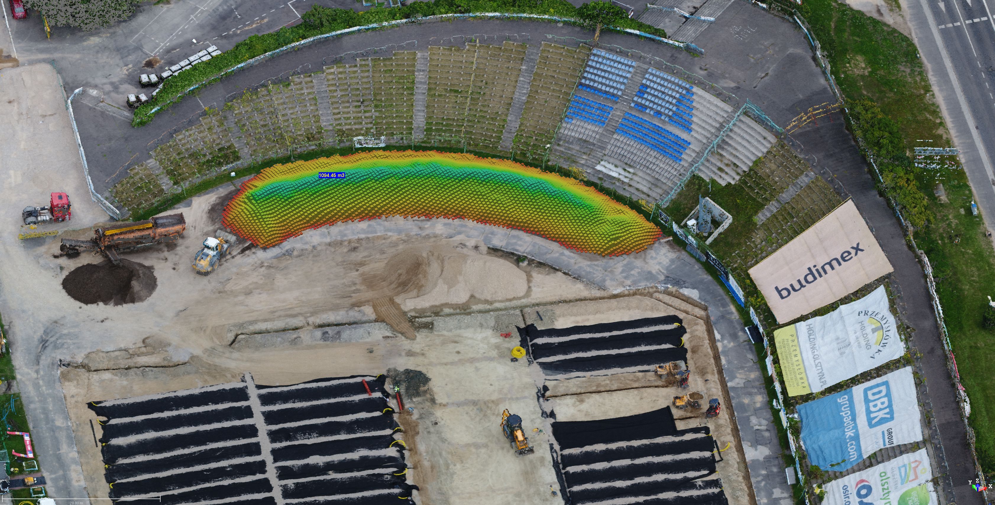
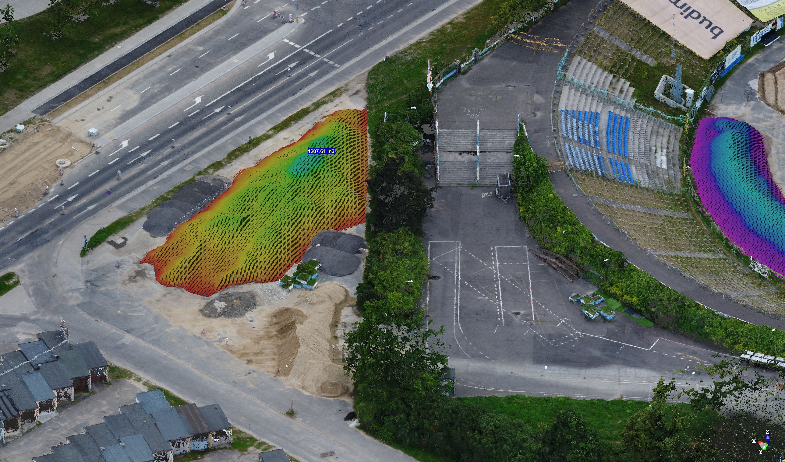
Geodetic investment service for the reconstruction of the Stomil Olsztyn stadium pitch.
The works include comprehensive geodetic service during the reconstruction of grasslands, replacement of underground installations and inventory of works performed.
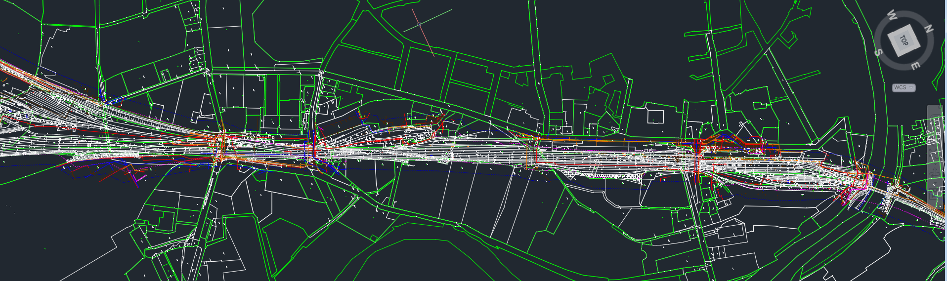
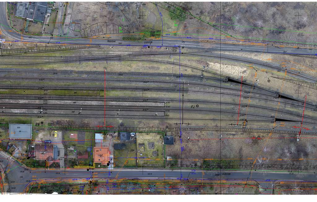
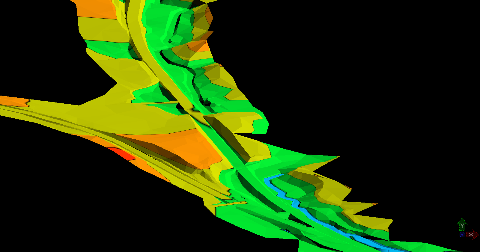
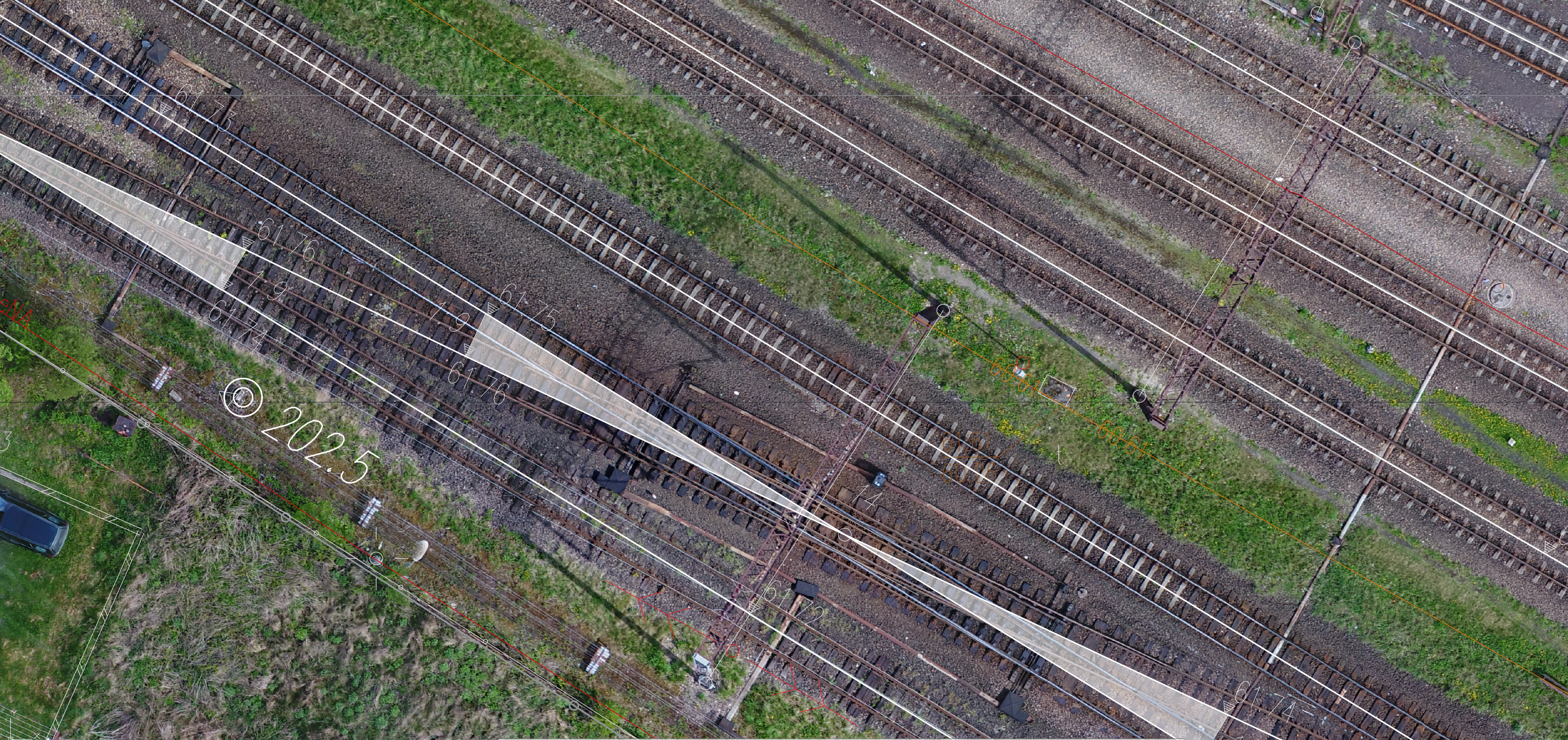
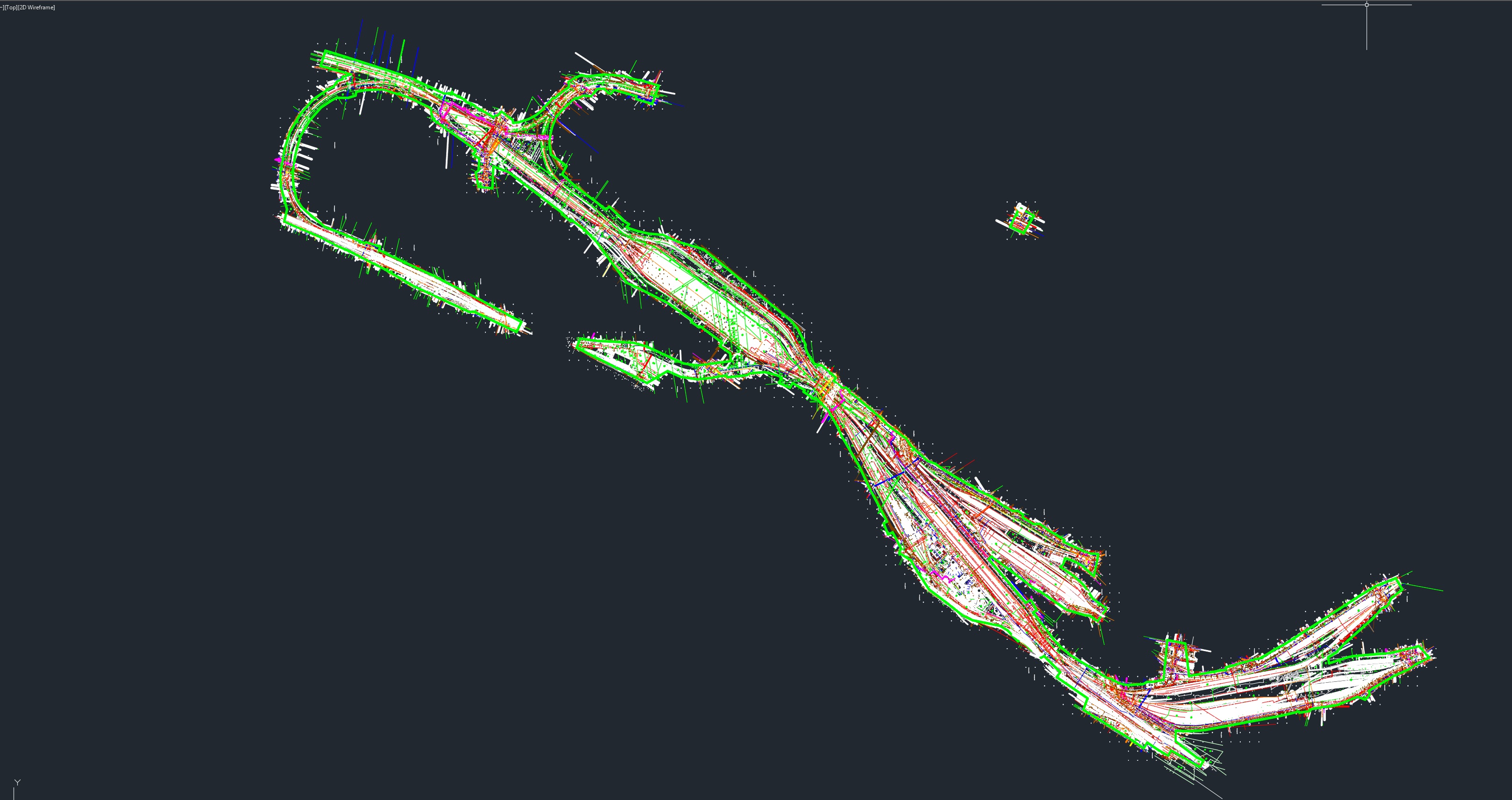
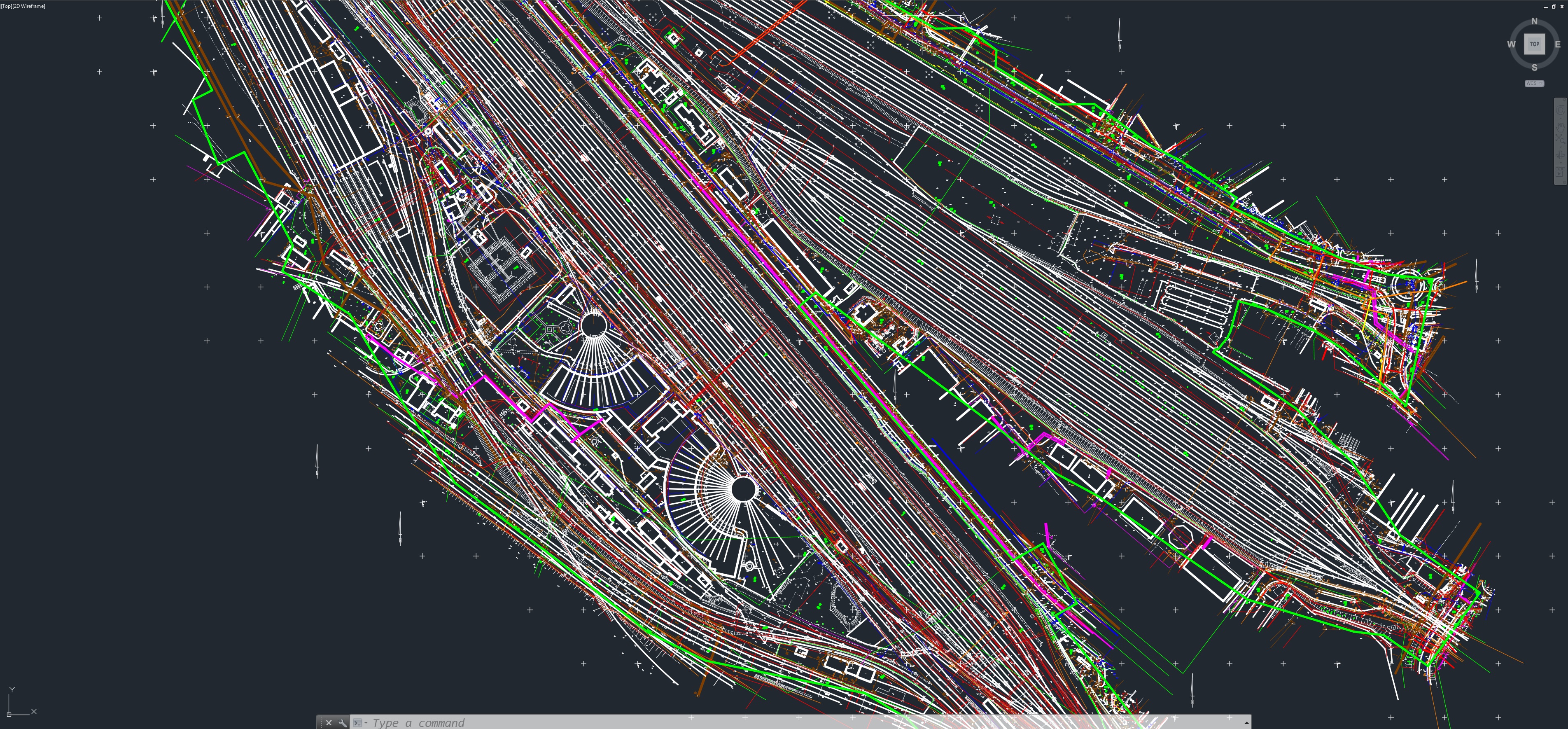
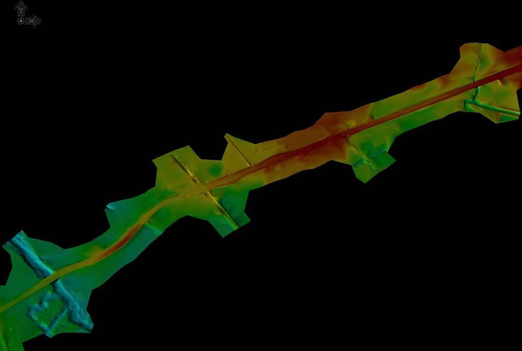
Map for design purposes for the LK38 railway line between Ełk and Korsze
We created a map for design purposes with a numerical terrain model for the LK38 Ełk-Korsze railway line with a total length of over 120 kilometers. The total area of the map is over 1,300 hectares. In addition, an orthophotomap was made for the stations on the route, also underground infrastructure was detected.
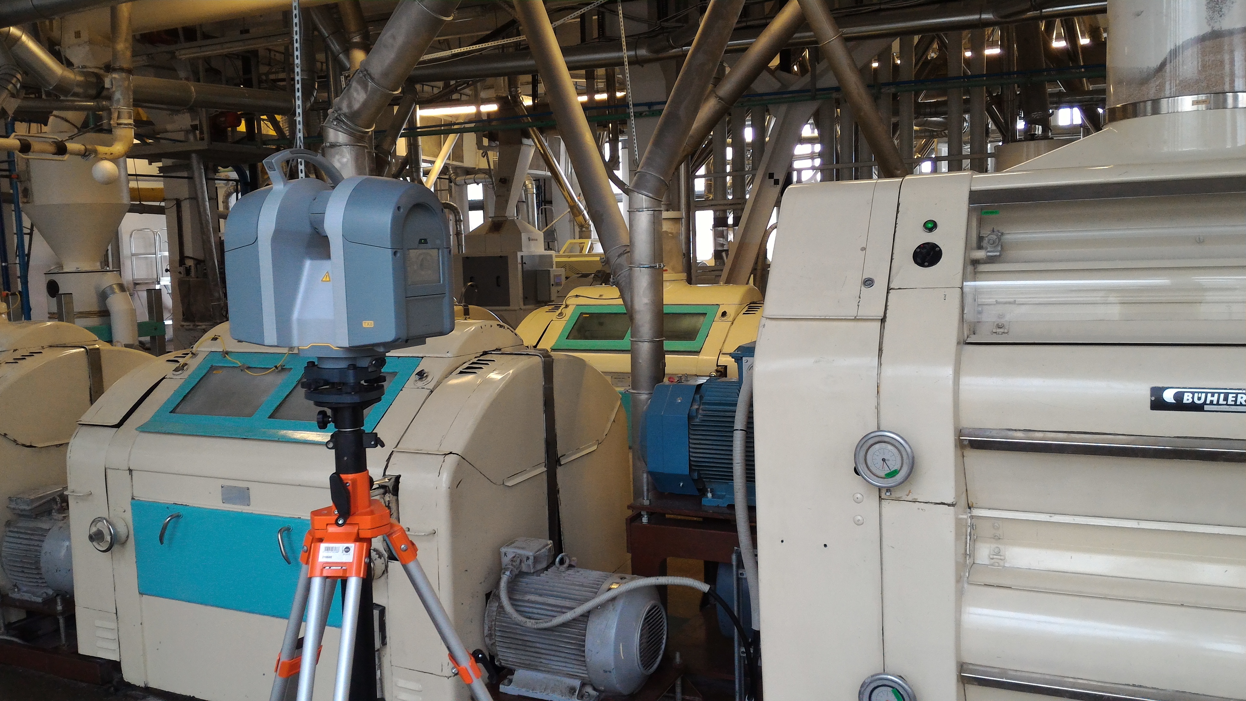
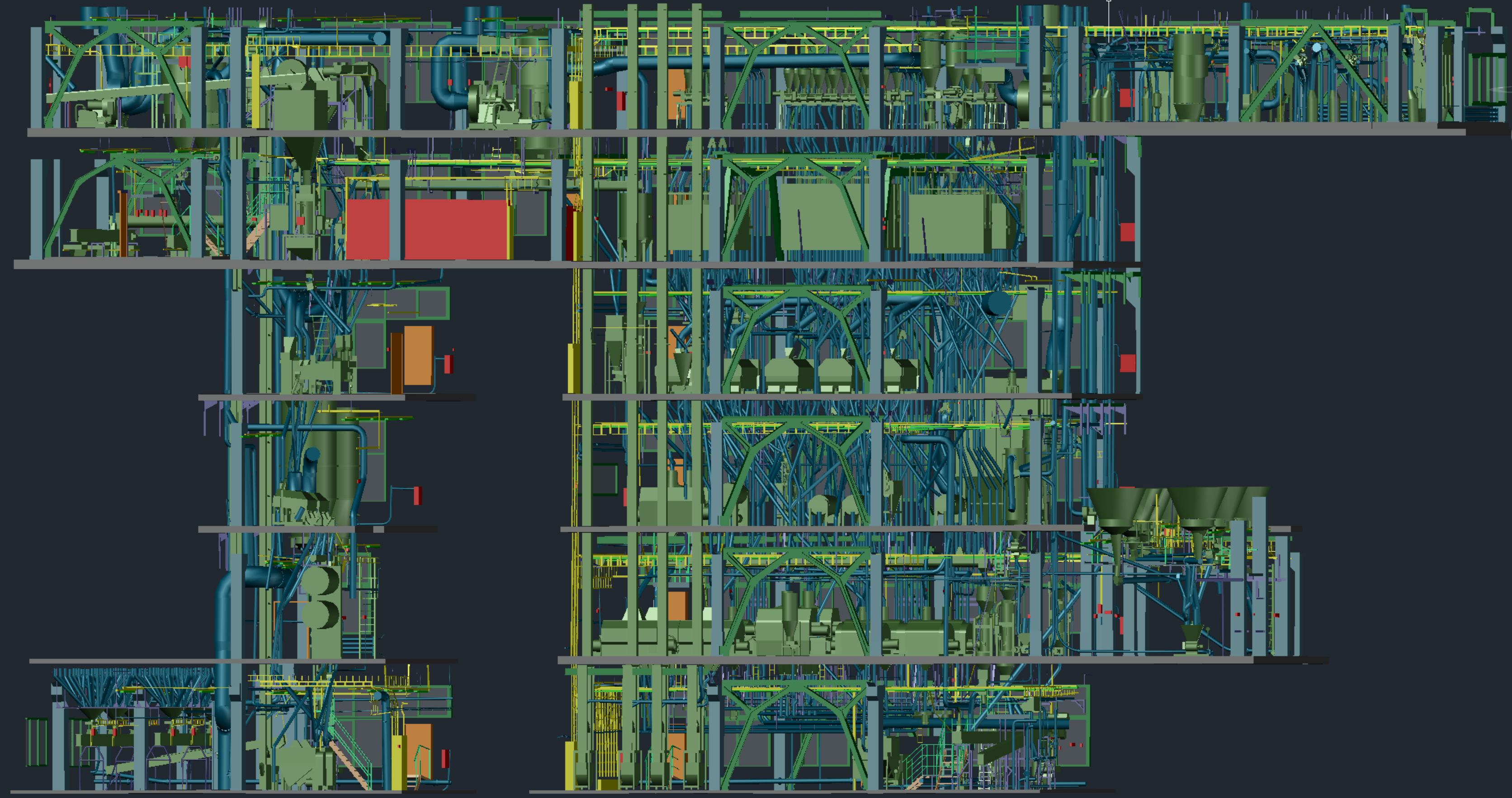
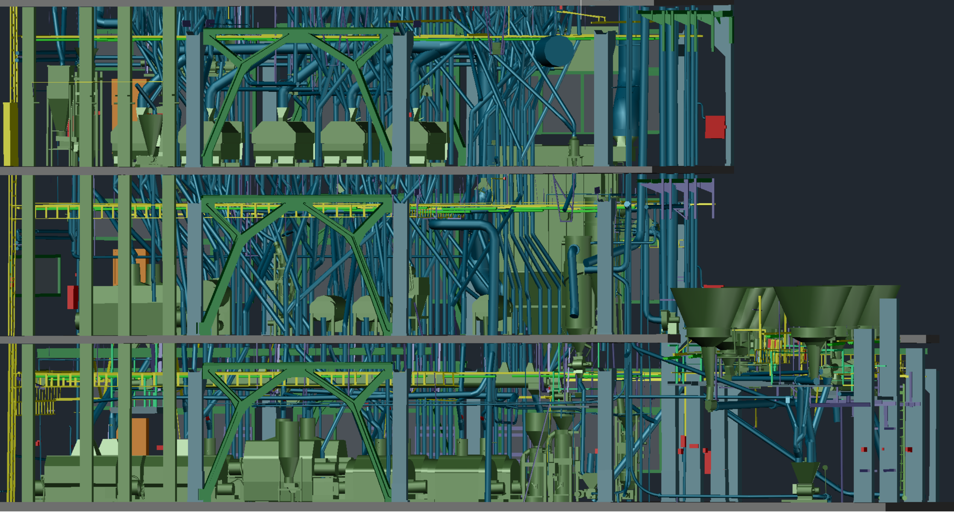
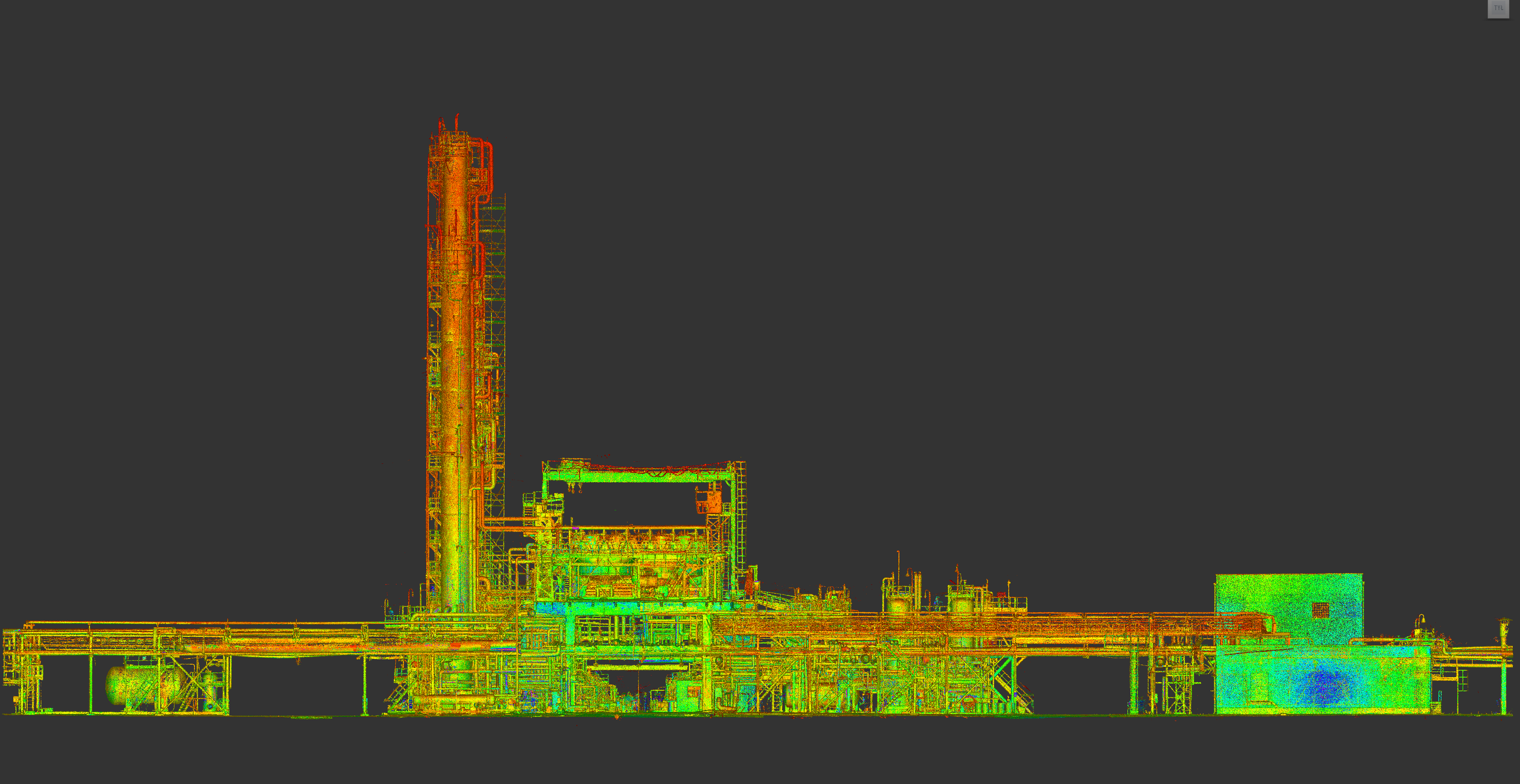
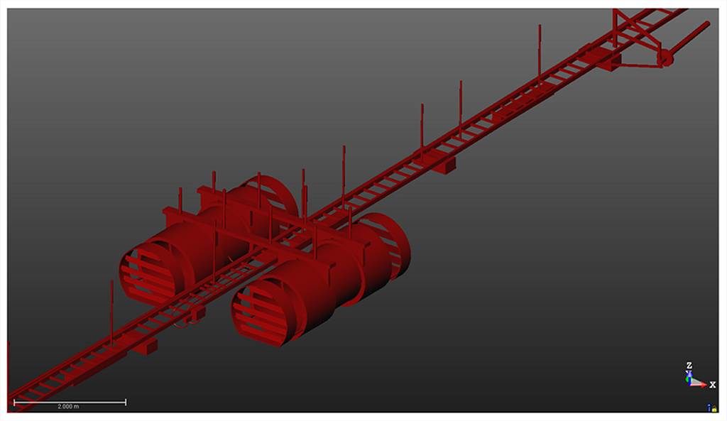
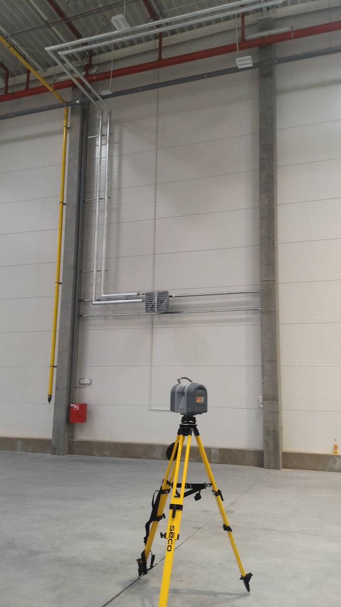
Modeling of the industrial plant Panevezys – Lithuania
For the needs of an industrial plant planning to add new installations and to increase production, laser scanning and 3D modeling were performed. The works were carried out for two buildings at the plant.
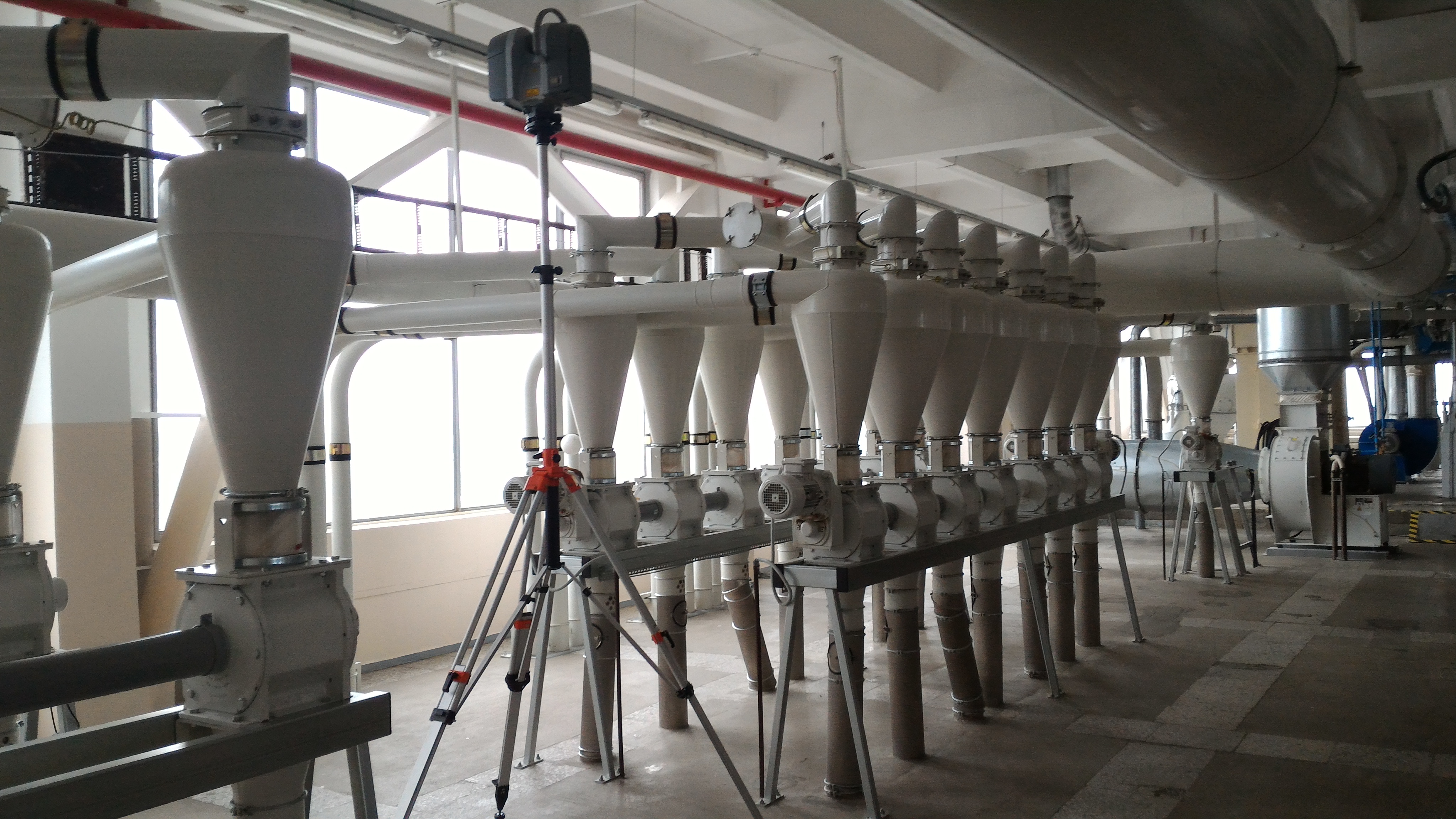
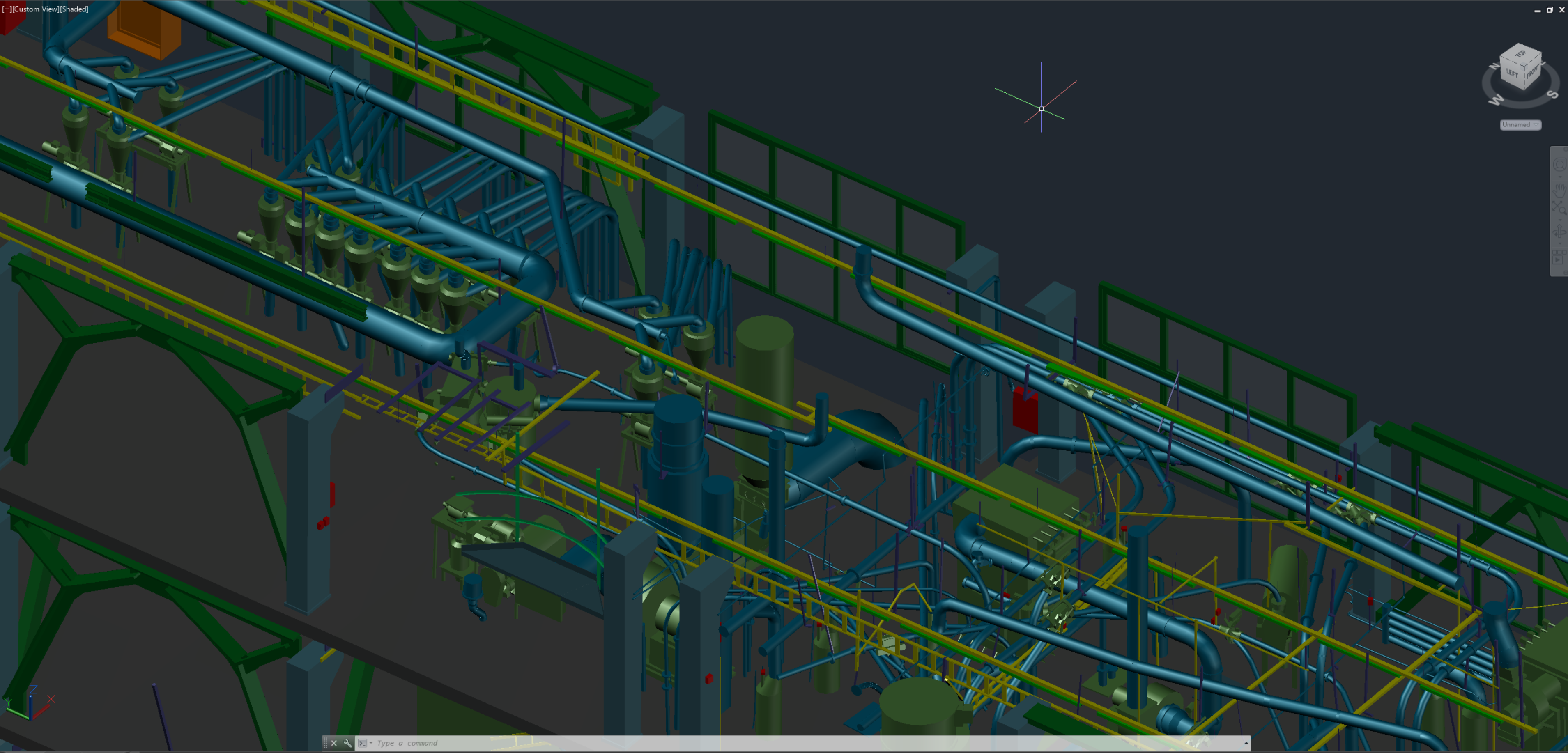
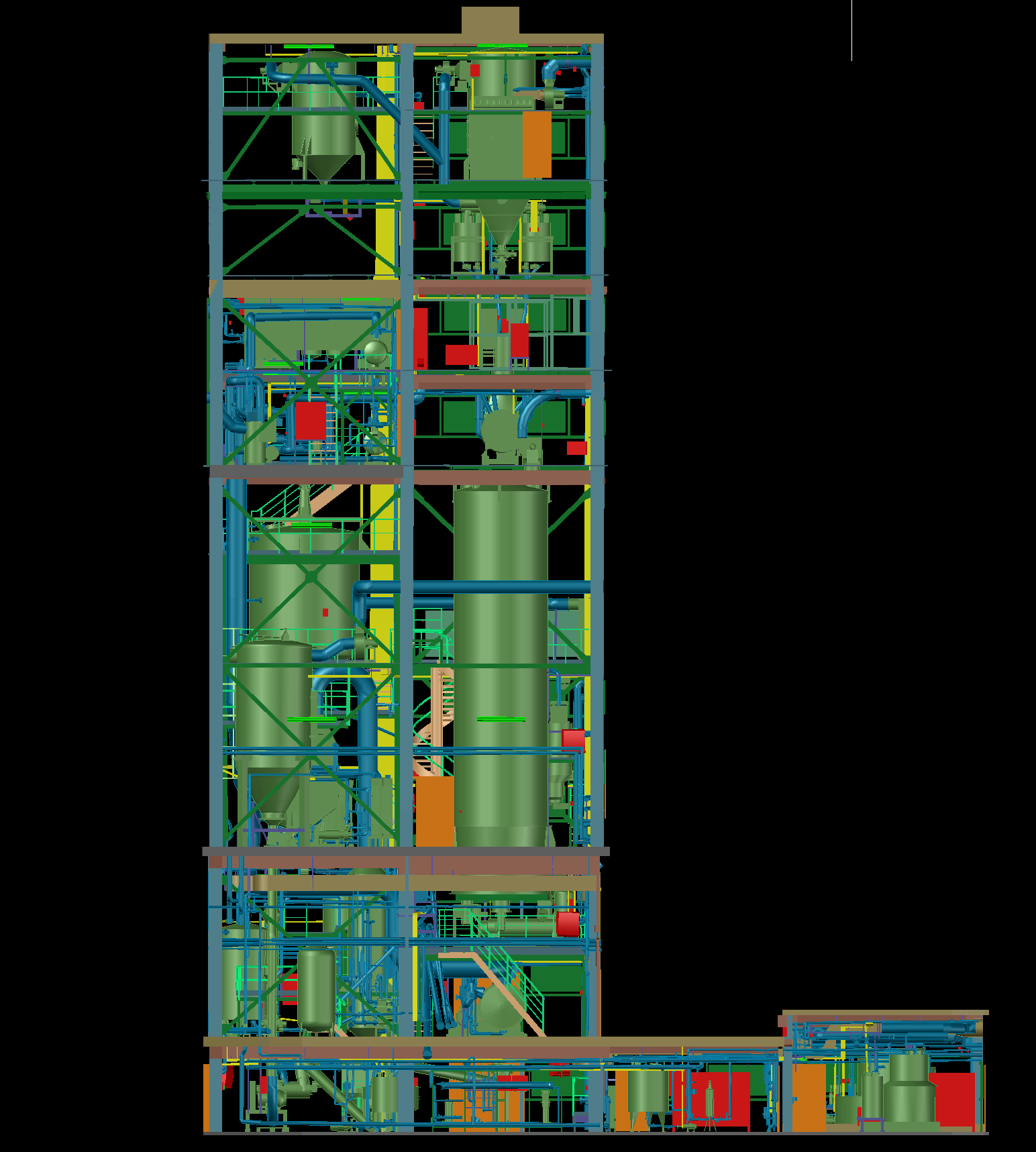
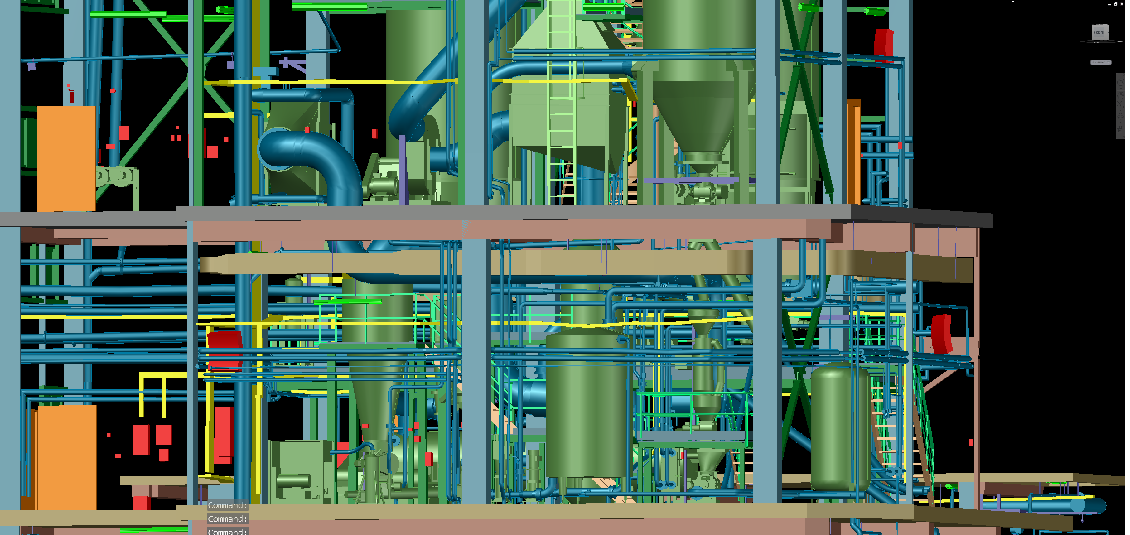
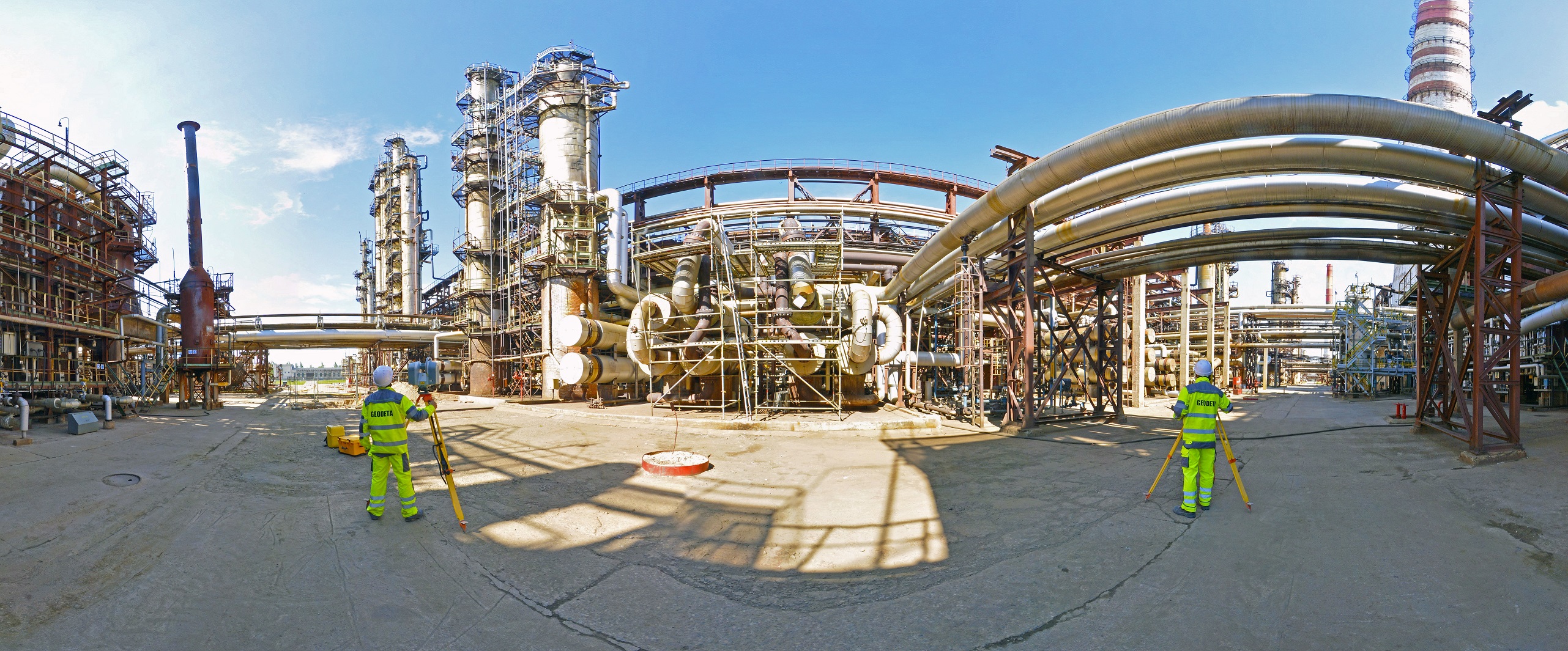
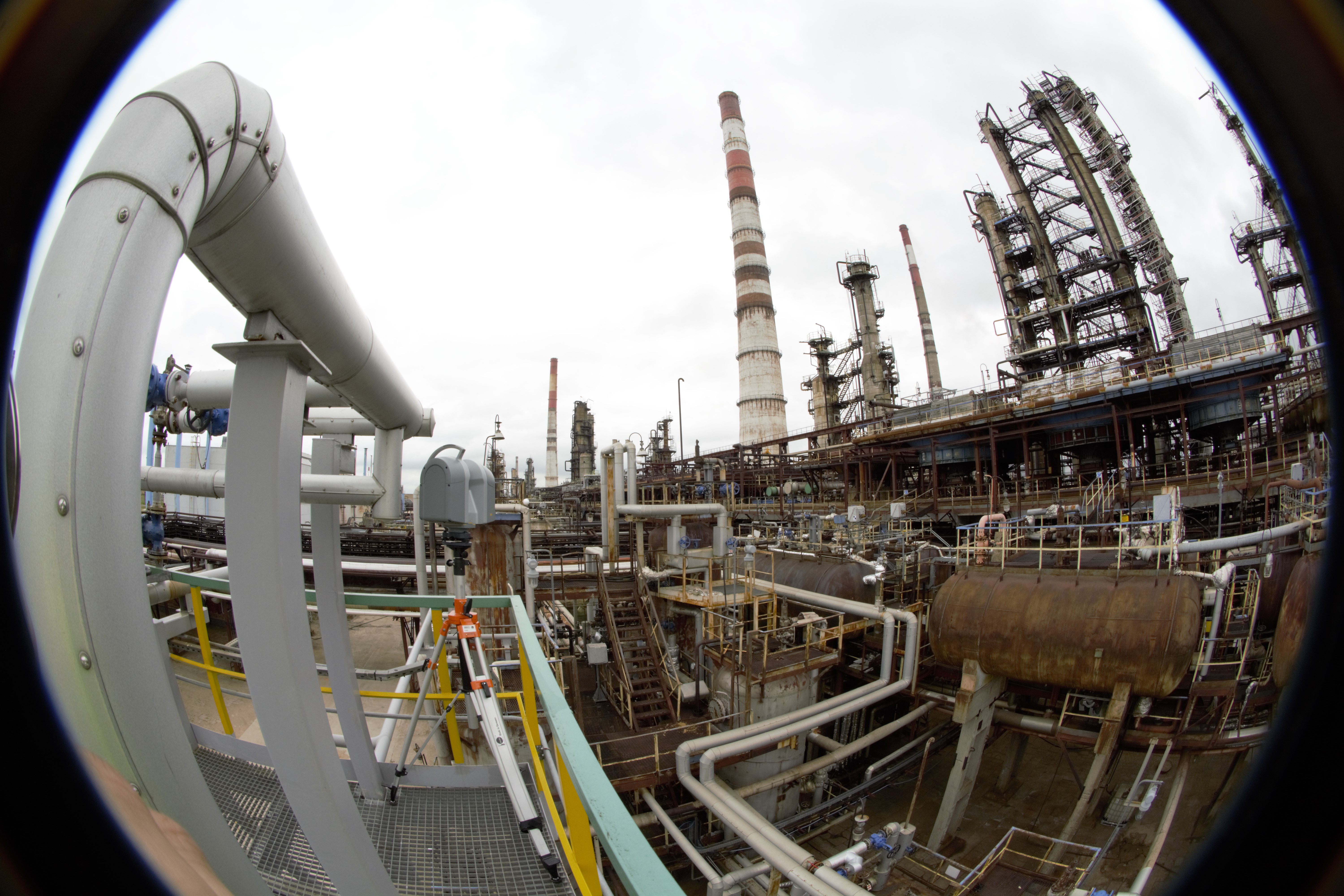
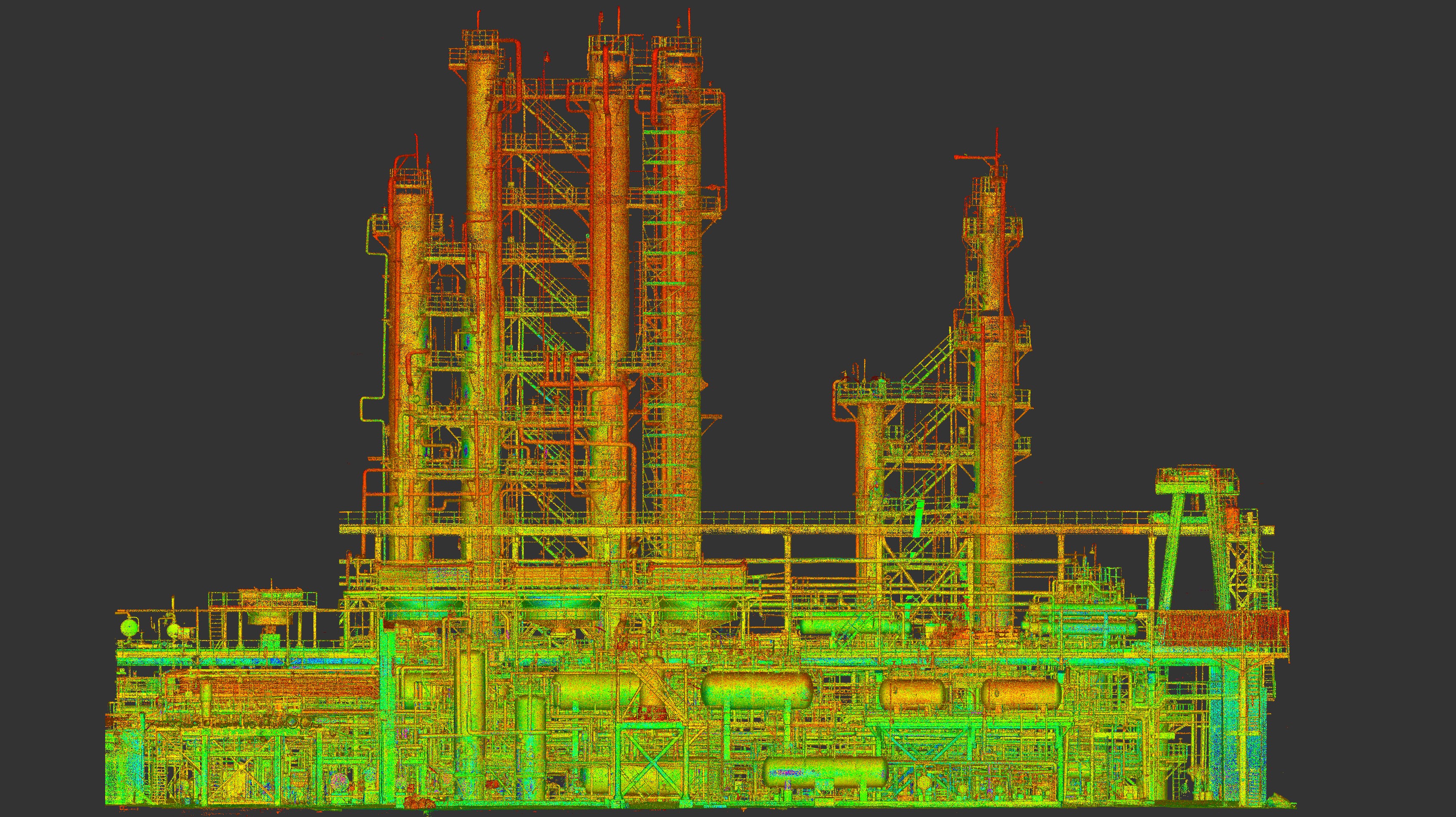
Orlen Mazeikiu Refinery – Lithuania
The aim of the work was to obtain a point cloud for a fragment of the Mazeikiu refinery. The data was used to design new installations. Over 200 scanner stations were made and the accuracy of fitting the point clouds to the geodetic network was 5 mm.
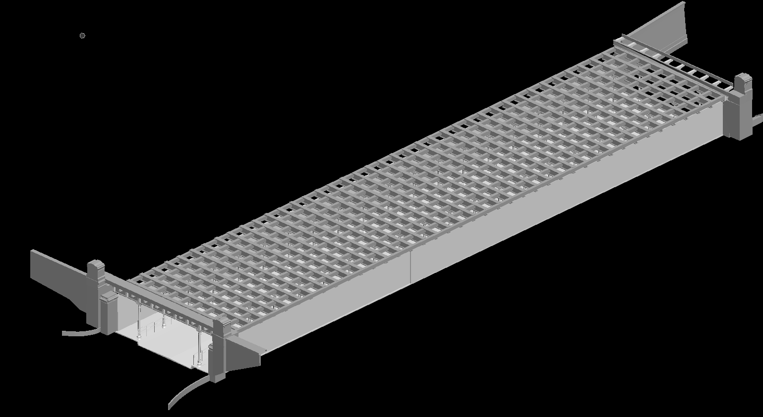
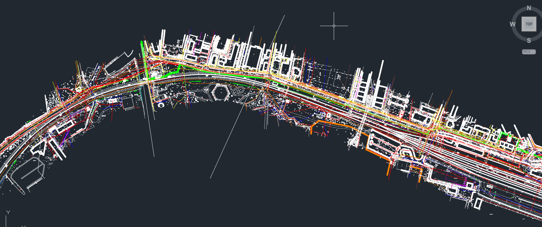
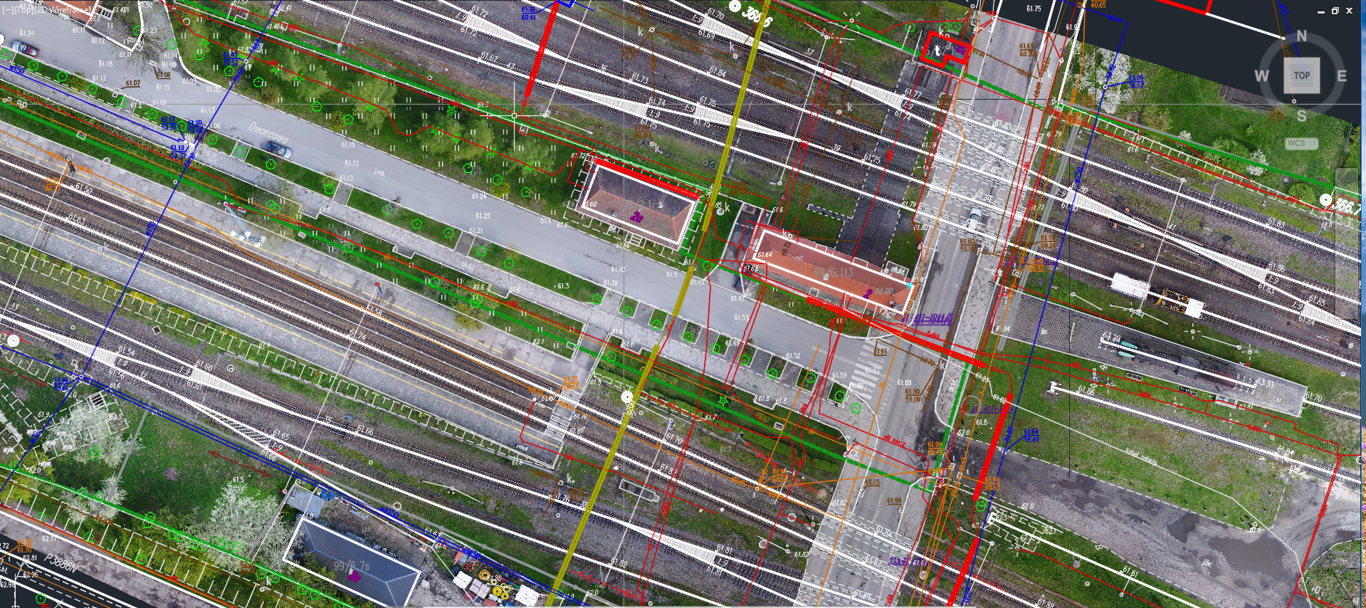
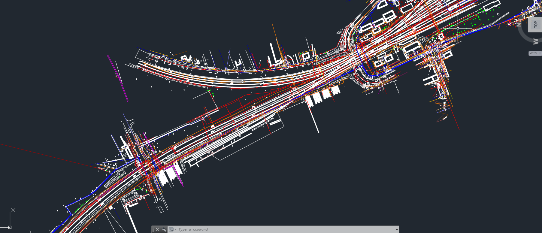
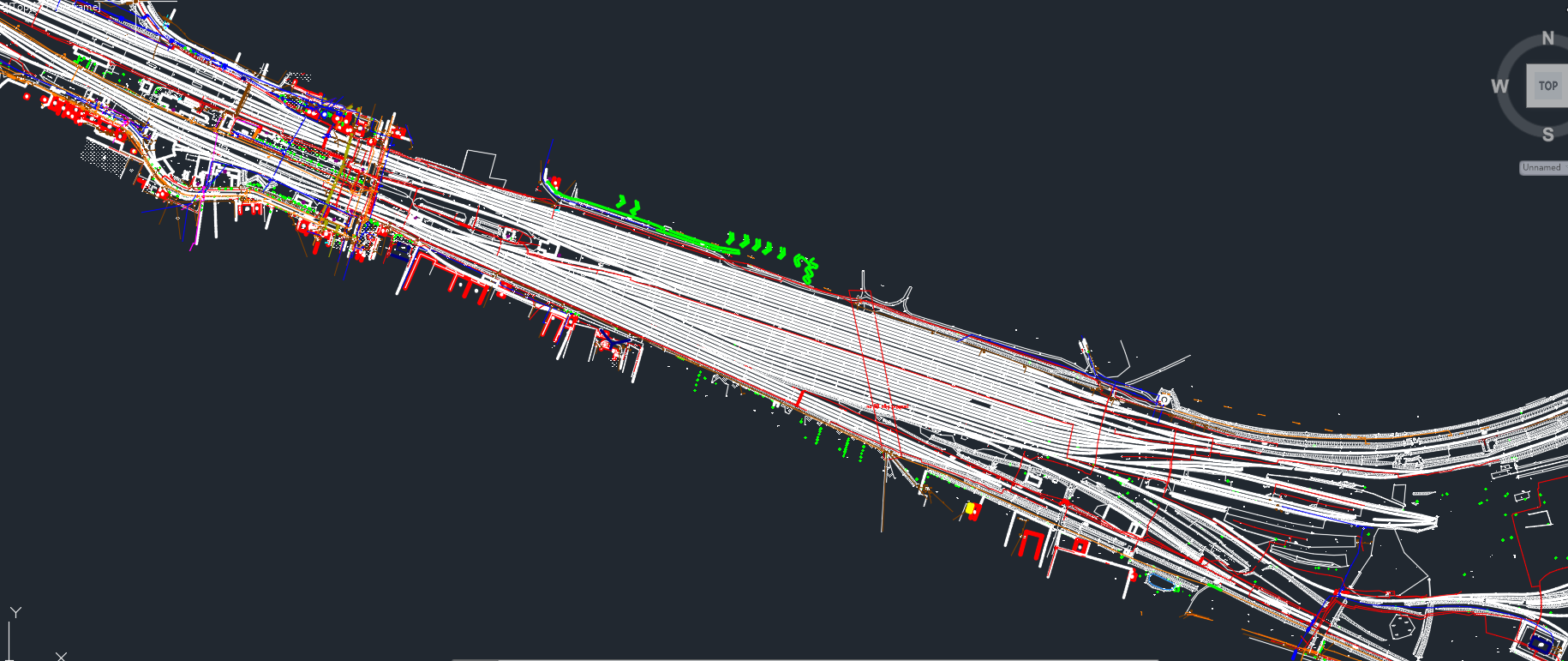
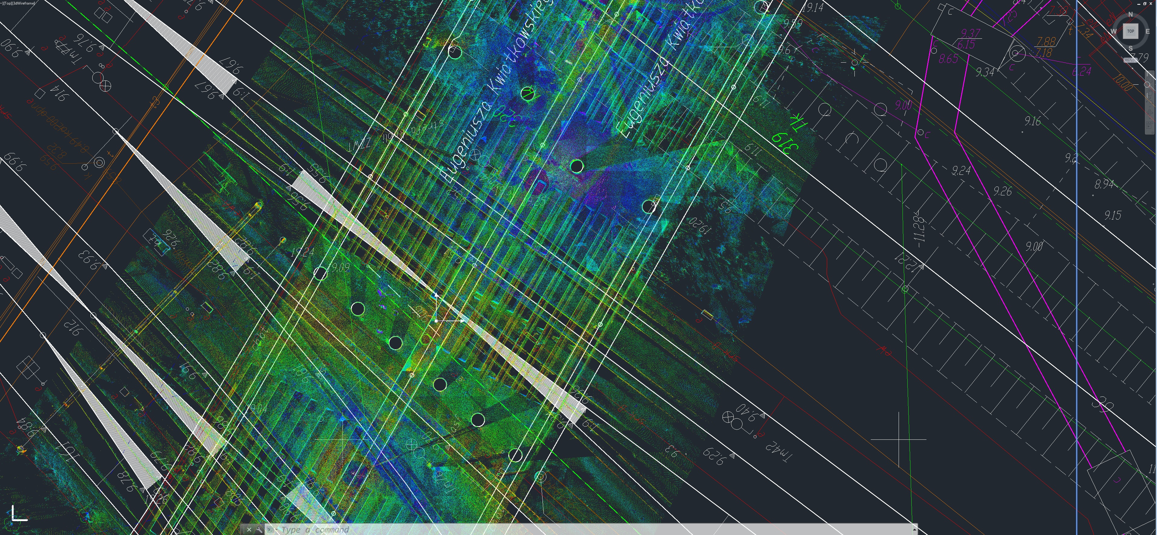
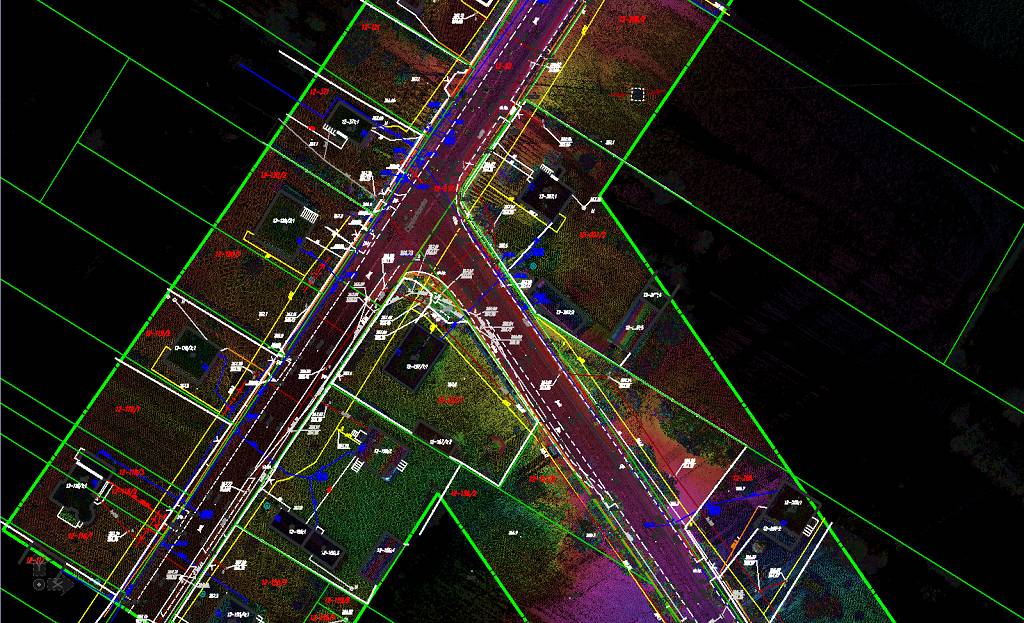
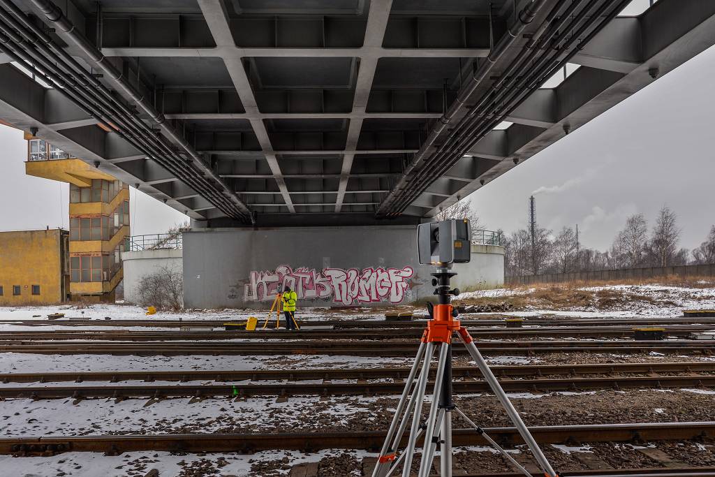
Map for design purposes – Gdynia Harbor
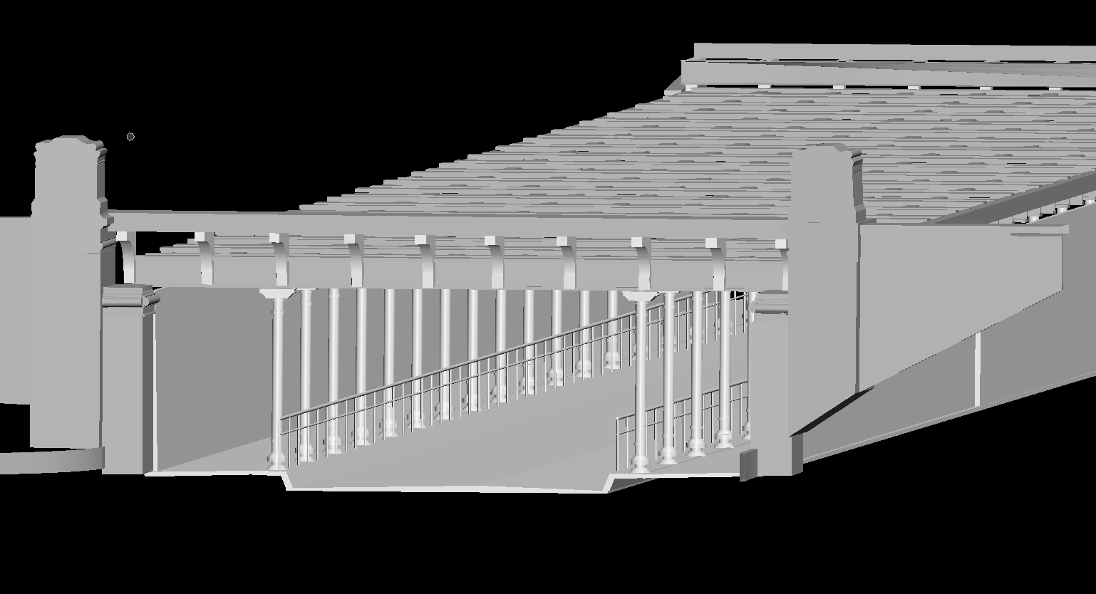
We created a map for design purposes for a large railway project called “Improvement of railway access to the sea port in Gdynia”. The area of the map was about 250 hectares, in addition, all engineering objects above or below the tracks were measured with a laser scanner and the drawings developed on the basis of a point clouds were made available to designers.
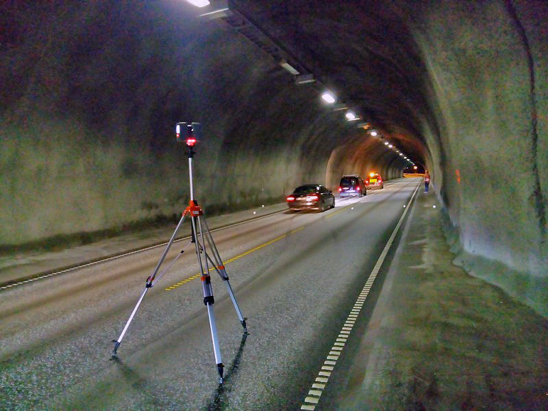
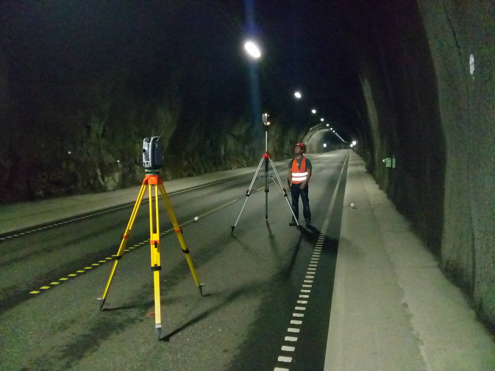
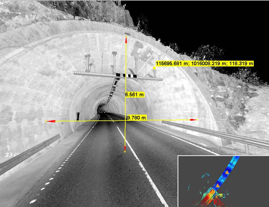
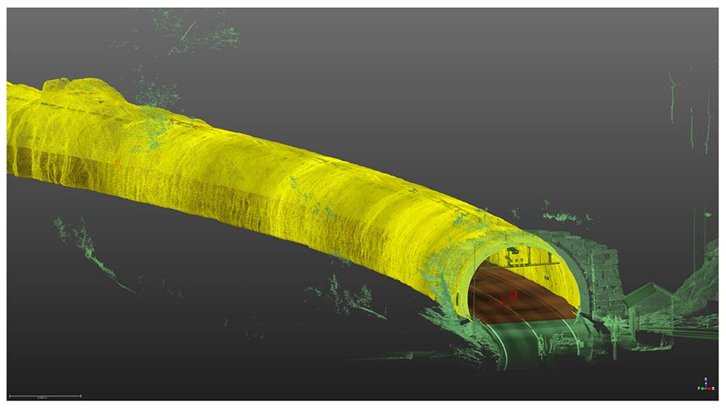
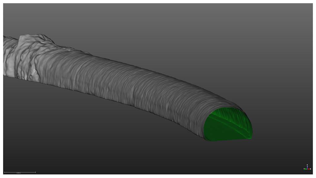
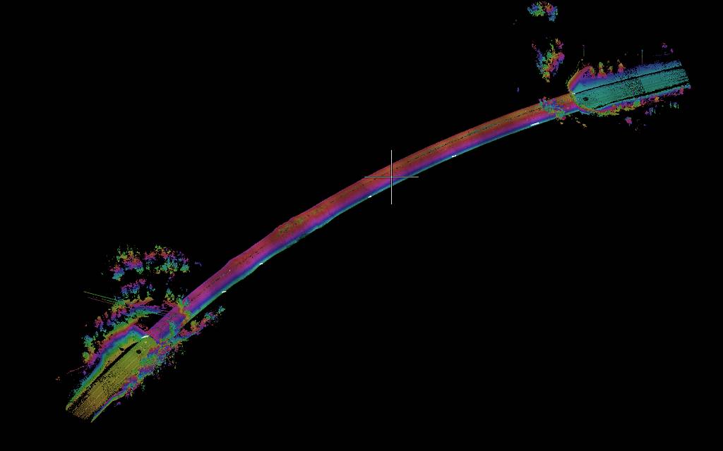
3D laser scanning of road tunnels near Lyngdal in Norway
The order was to provide for each of the eleven tunnels a classified point cloud, numeric modells of the road and wall surfaces and a 3D parametric model of all installations inside. In addition we also provided TrueViews, that allowed our customer to quickly perform measurements inside the tunnels from the web browser. The longest of the measured tunnels was 3500 meters long.
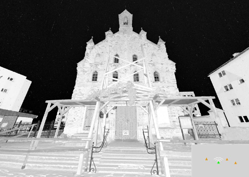
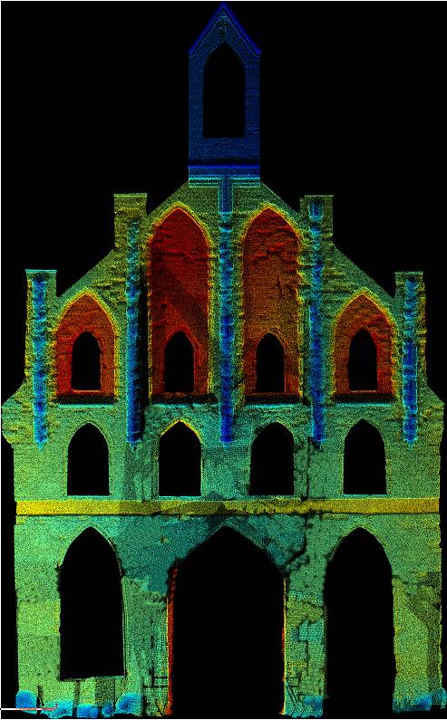
Braniewo Church
Based on the point cloud we perform a complete elevations deformation analysis and wall verticality examination for the Ukrainian Greek Catholic Church in Braniewo.

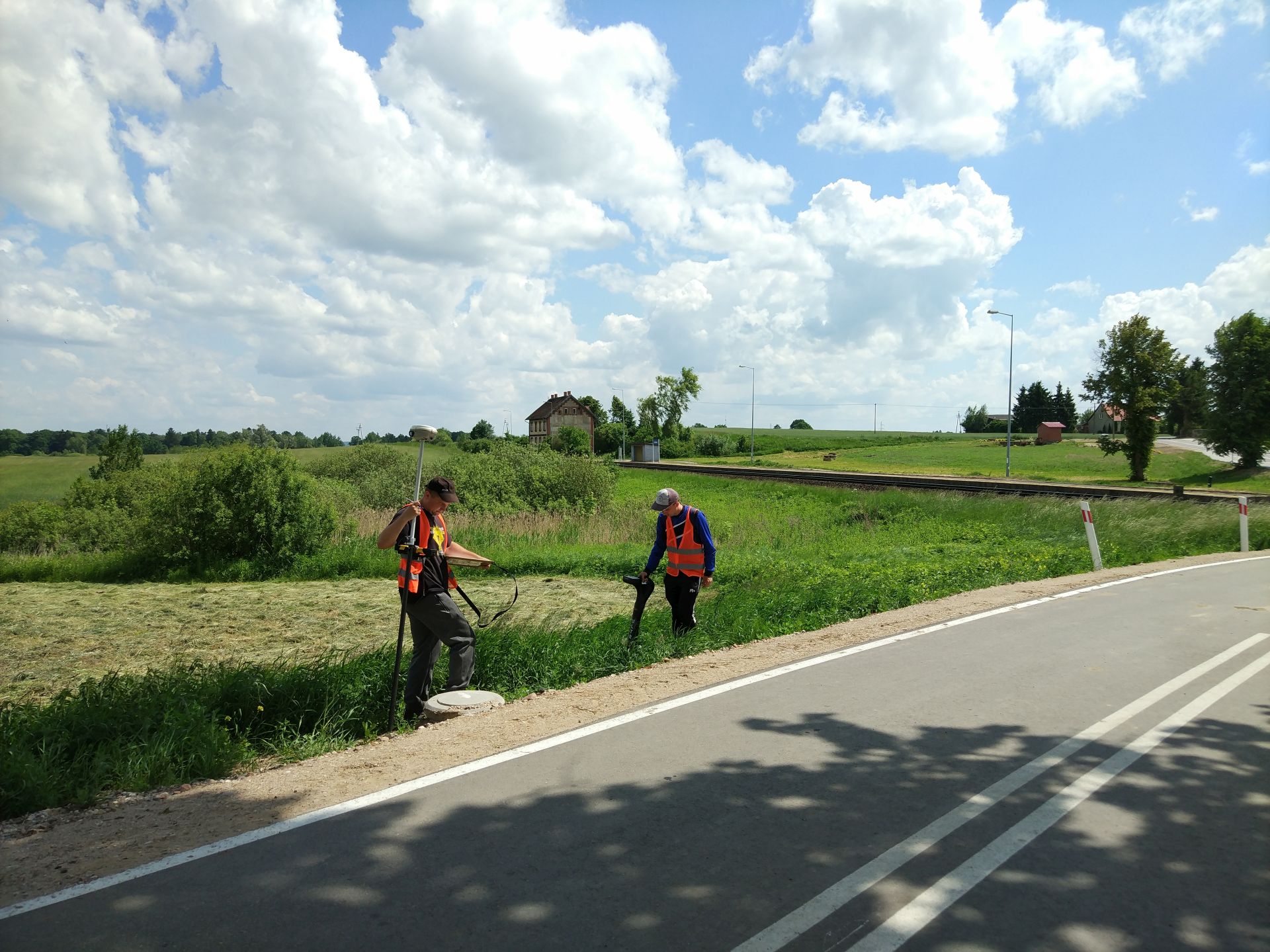
Road 908 Czestochowa – Tarnowskie Gory
We have acquired a point cloud for 43 km part of road 908 Czestochowa-Tarnowskie Gory. Based on our measurements we created a 3D vector map for design purposes and a precise digital terrain model.
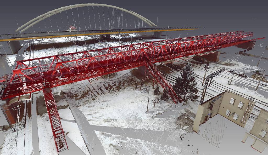
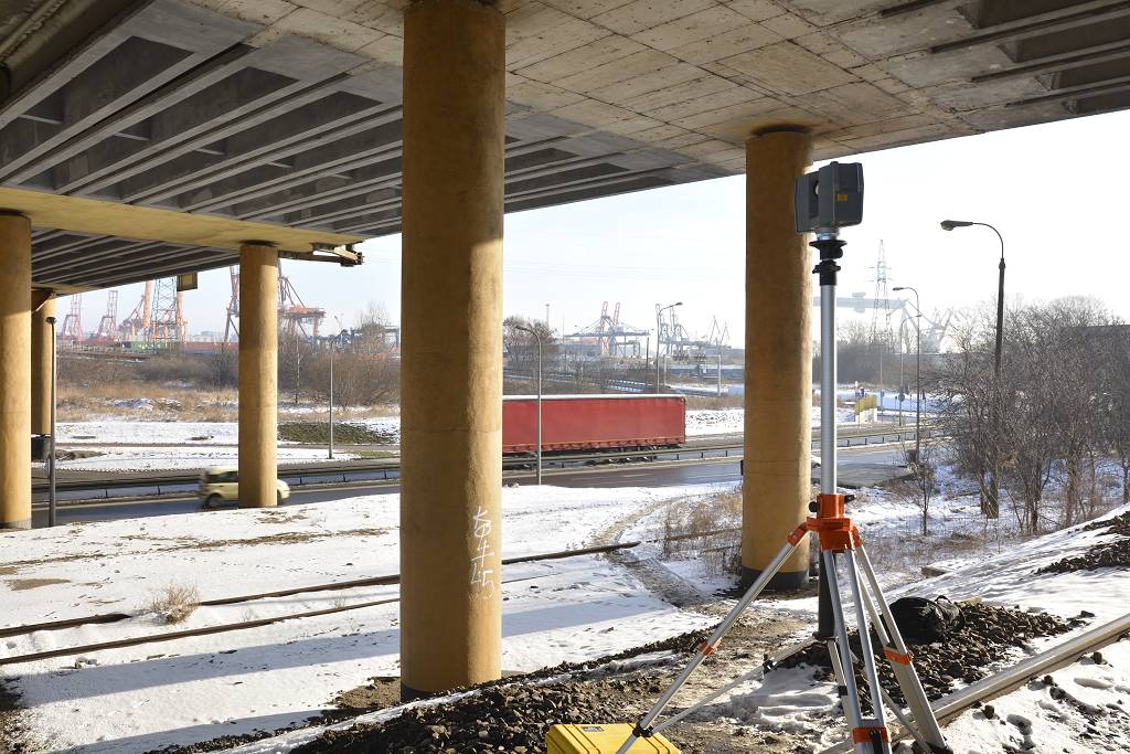
Scanning of engineering objects Gdansk.
Measurement of 13 engineering objects above railway line 226. Based on the point cloud we also check clearance profiles for every track.
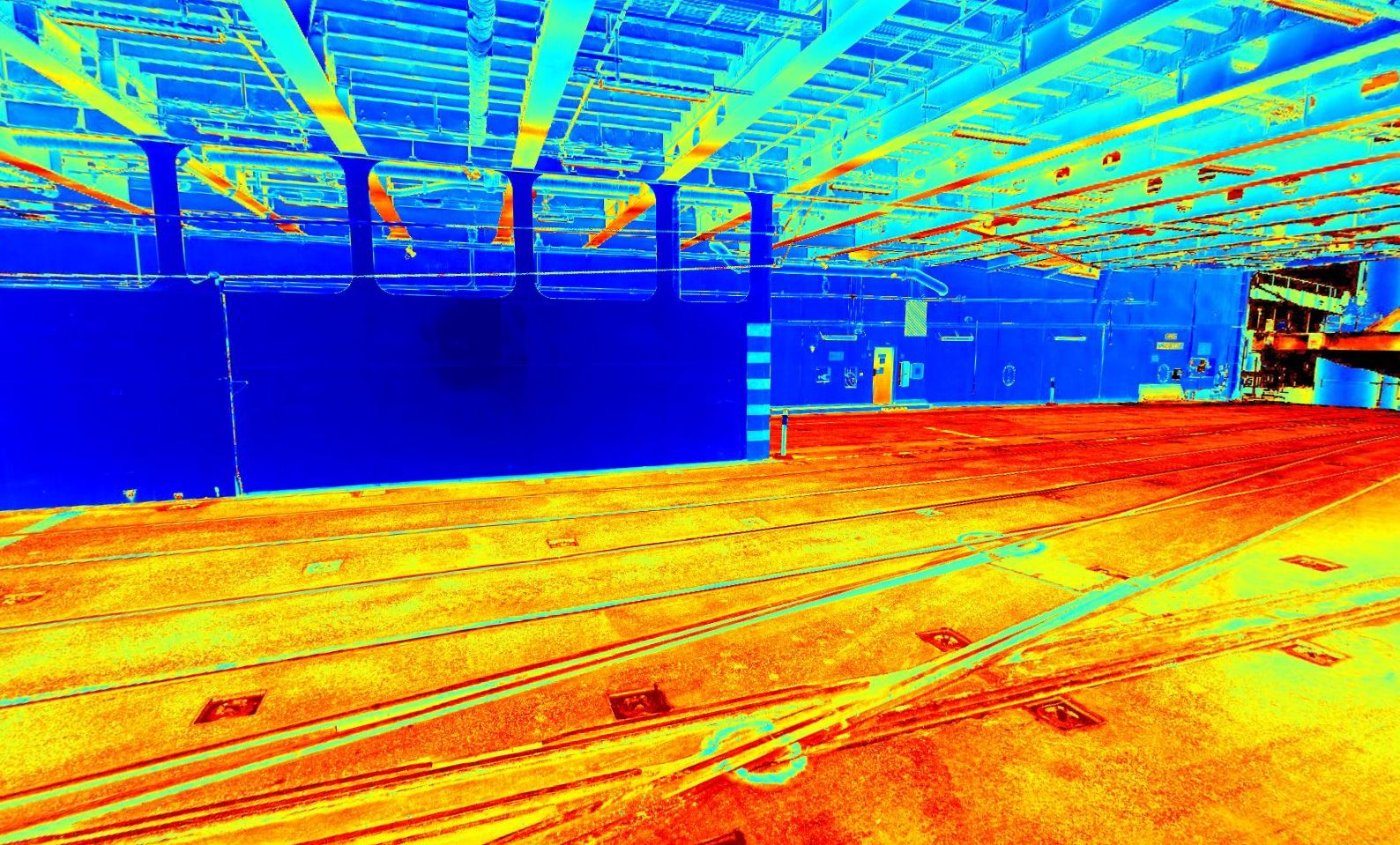
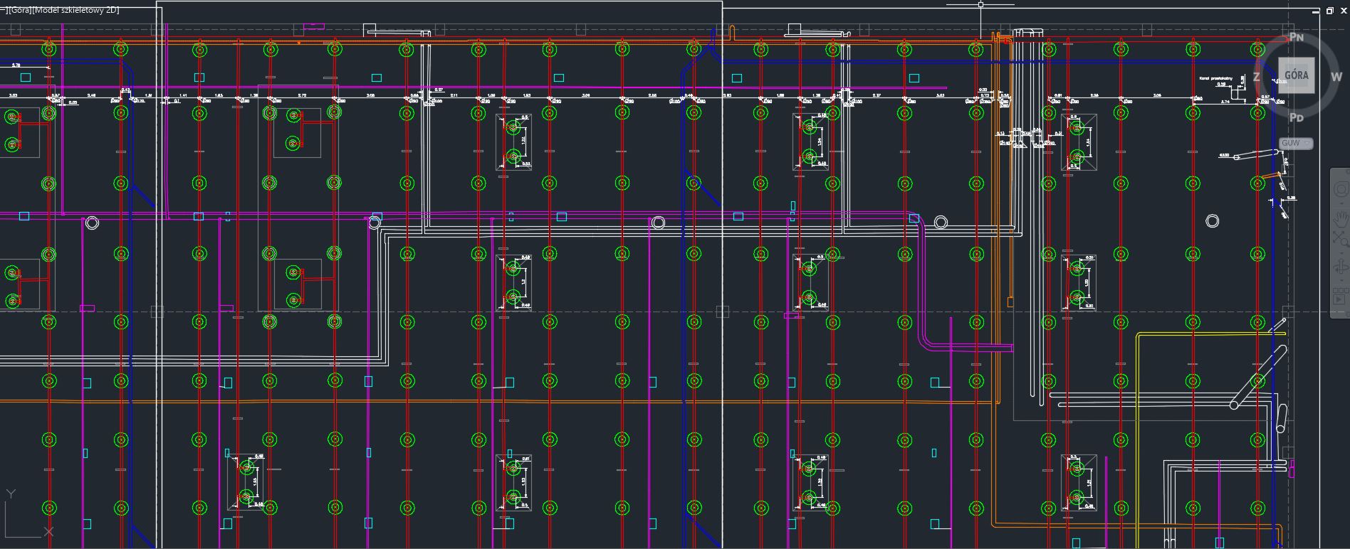
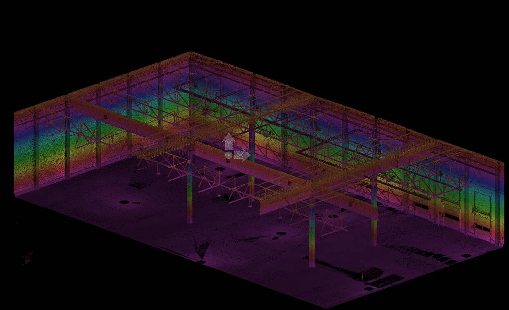
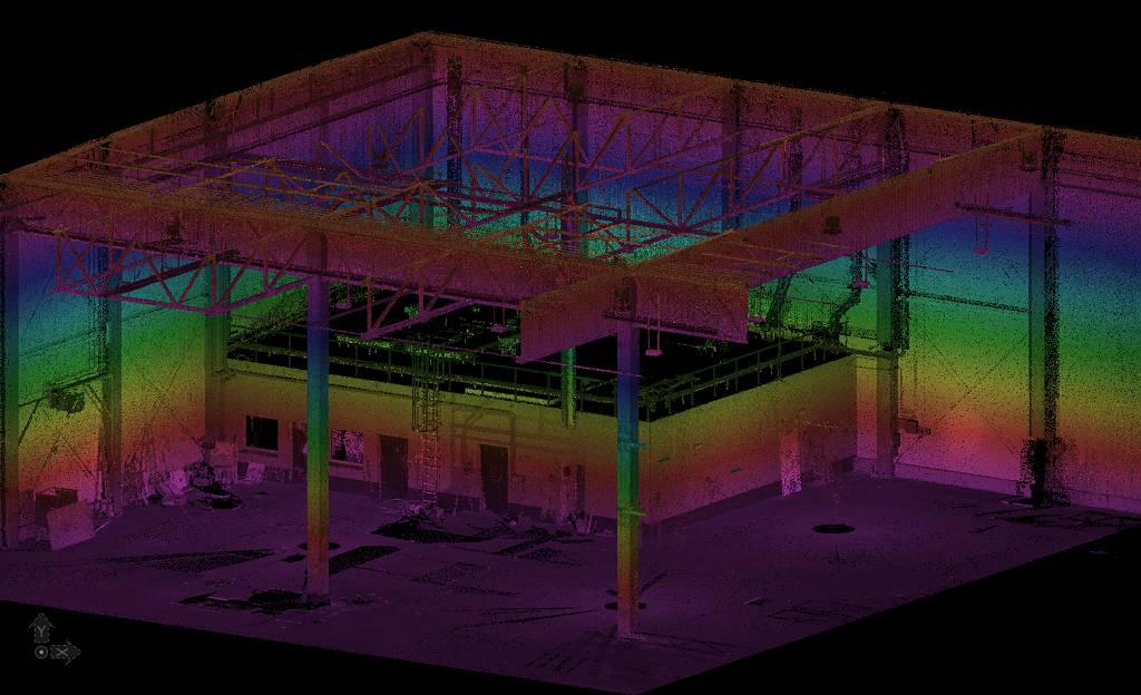
Industry Hall inventorisation
We created plans and sections drawings containing every installation inside a industry hall. All drawings were made based on a point cloud.

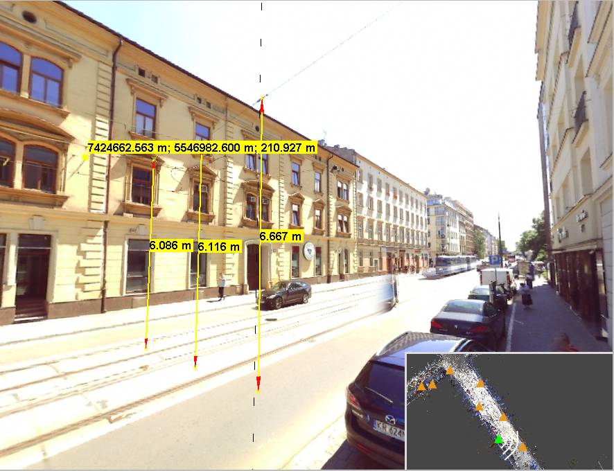
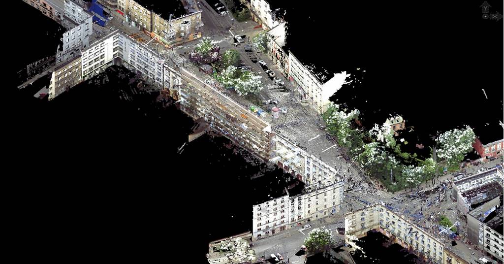
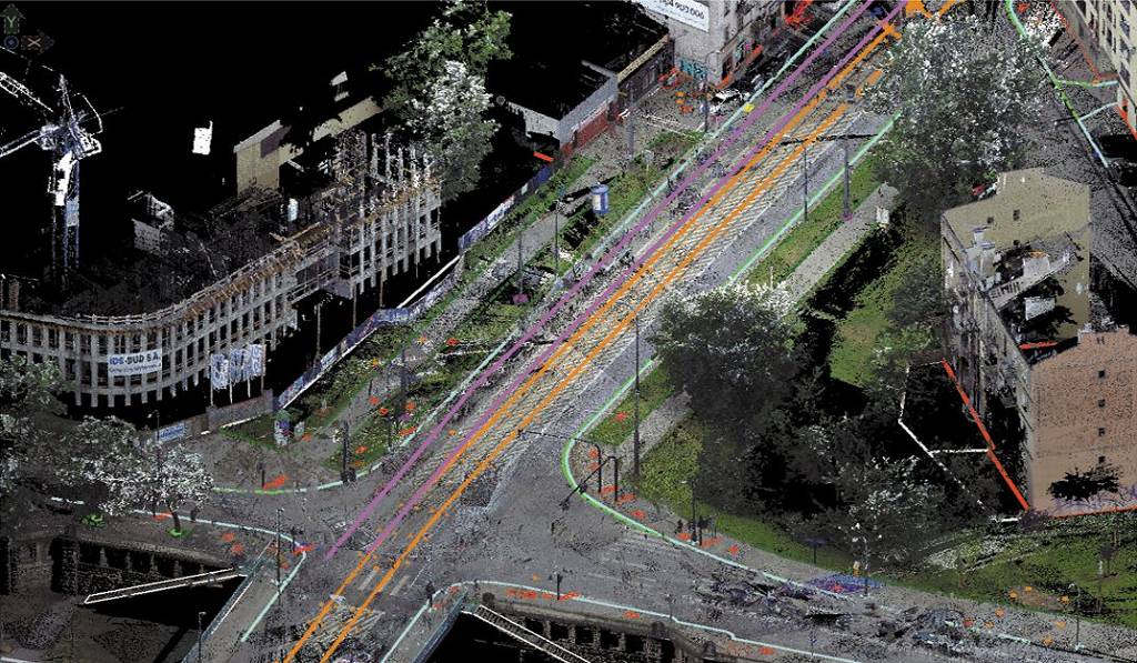
Krakow Starowislna street
For 1500 meters of urban streets in Krakow we created a 3D map for design purposes, scanning of elevations for every building on the street and a complete inventorisation of overhead tram traction lines with anchor points.
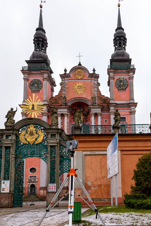
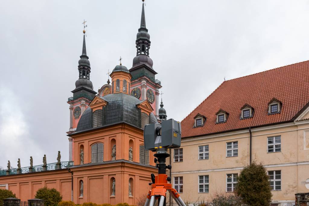
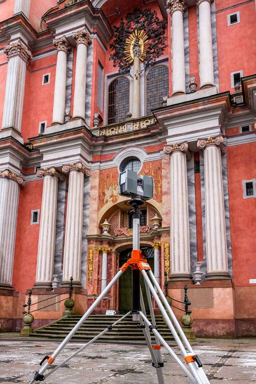
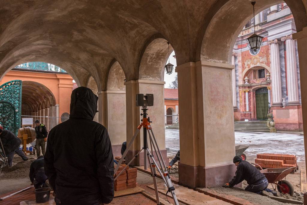
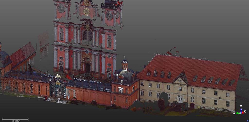
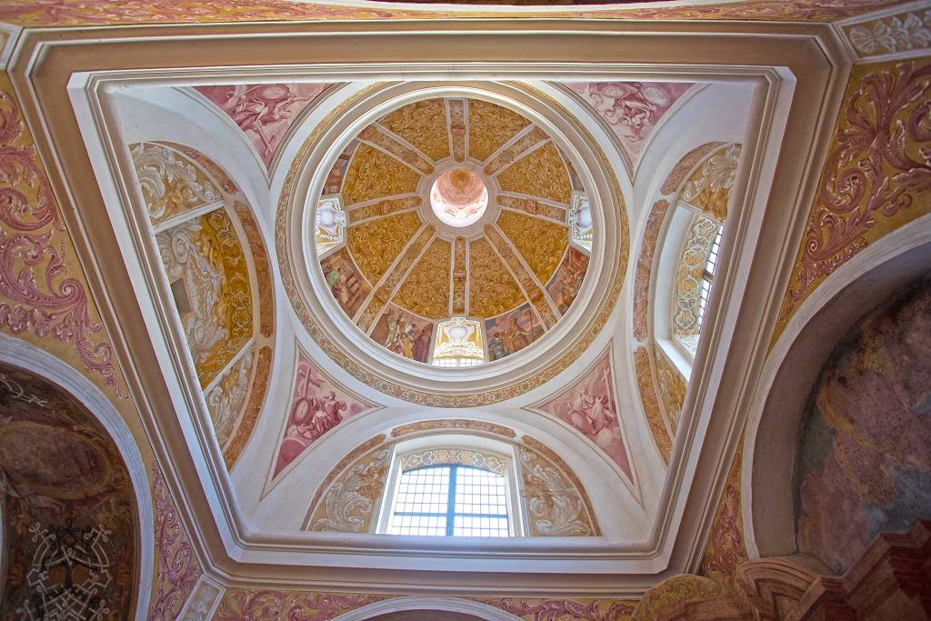
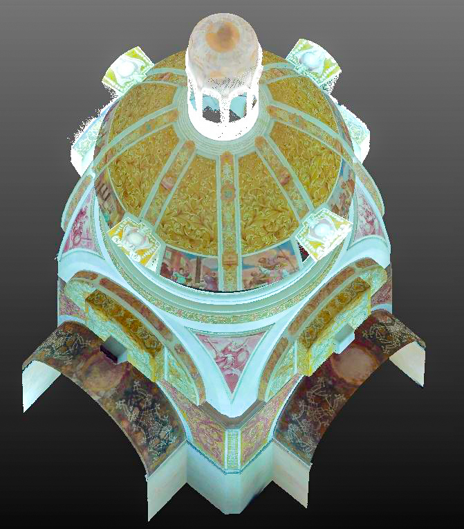
St. Lipka sanctuary
3D survey of a part of St. Lipka sanctuary. The survey was focused on the sanctuary cloisters and the exterior wall chapel.
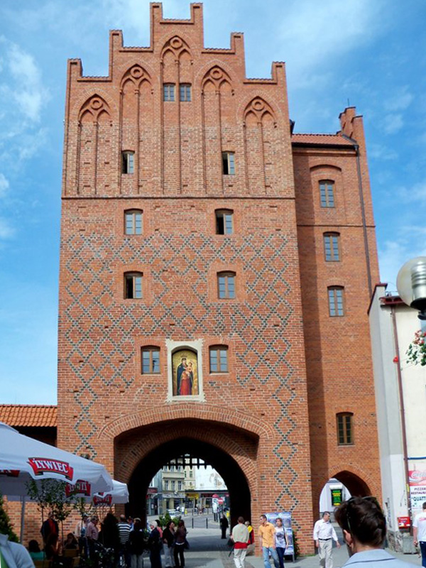
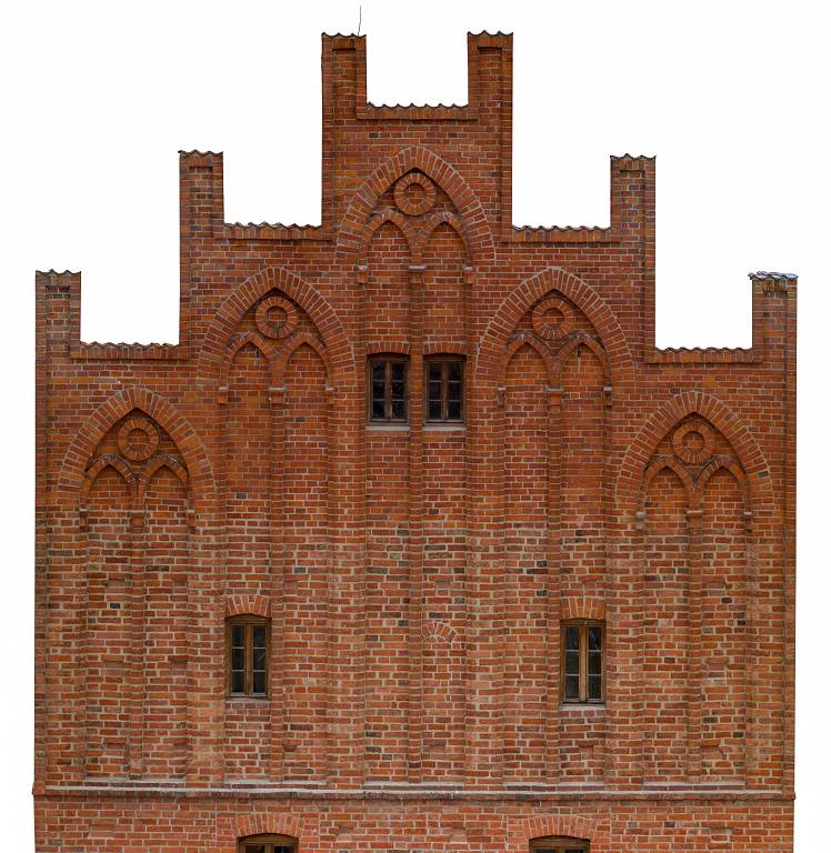
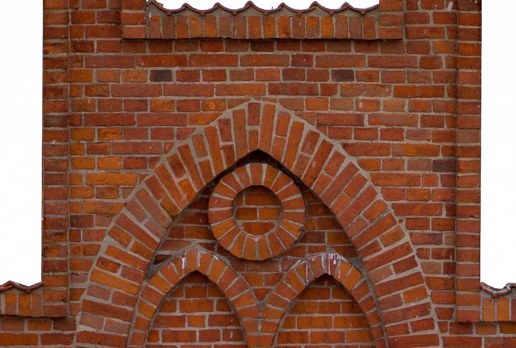
Olsztyn The High Gate
We created a high resolution orthophotos for all elevations of High Gate in Olsztyn old town. Pixel resolution is under 2 millimeters.